Approximate Location Map
Large Map »
Latitude: 51.6306 / 51°37'50"N
Longitude: -0.7527 / 0°45'9"W
OS Eastings: 486425
OS Northings: 193157
OS Grid: SU864931
Mapcode National: GBR D54.NJ4
Mapcode Global: VHDW4.W8XT
Plus Code: 9C3XJ6JW+6W
Entry Name: 1, Oxford Street
Listing Date: 28 June 1973
Grade: II
Source: Historic England
Source ID: 1332387
English Heritage Legacy ID: 46122
ID on this website: 101332387
Location: High Wycombe, Buckinghamshire, HP11
County: Buckinghamshire
Electoral Ward/Division: Abbey
Parish: Non Civil Parish
Built-Up Area: High Wycombe
Traditional County: Buckinghamshire
Lieutenancy Area (Ceremonial County): Buckinghamshire
Church of England Parish: High Wycombe All Saints
Church of England Diocese: Oxford
Tagged with: Building
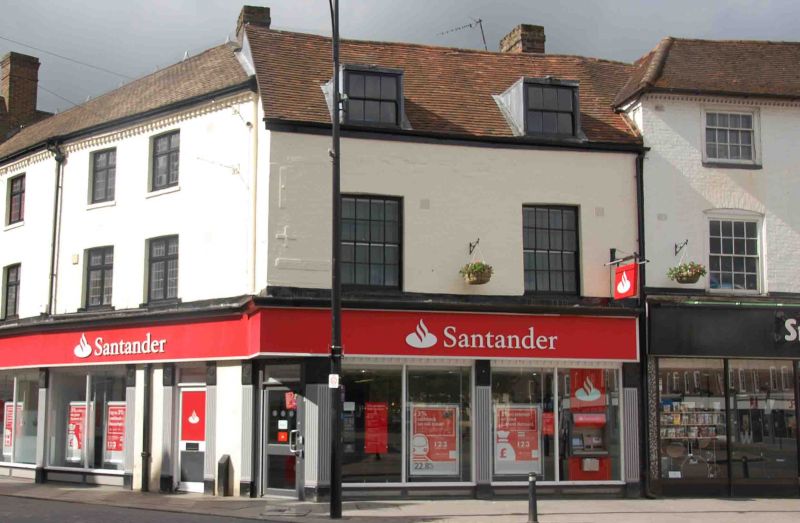
OXFORD STREET
1.
963
(South Side)
No 1
SU 8693 SW 3/302
II
2.
C18 front. Colour washed brick, old tiled roof. 2 storeys and attic,
cornice. 2 box sash dormers with glazing bars, 2 1st floor sashes in reveals
under flat arches with glazing bars. Modern shop, tall fascia, no cornice.
Listing NGR: SU8642593157
External links are from the relevant listing authority and, where applicable, Wikidata. Wikidata IDs may be related buildings as well as this specific building. If you want to add or update a link, you will need to do so by editing the Wikidata entry.


Other nearby listed buildings
