Approximate Location Map
Large Map »
Latitude: 51.7254 / 51°43'31"N
Longitude: -0.654 / 0°39'14"W
OS Eastings: 493067
OS Northings: 203819
OS Grid: SP930038
Mapcode National: GBR F5F.X1B
Mapcode Global: VHFS2.MW4P
Plus Code: 9C3XP8GW+5C
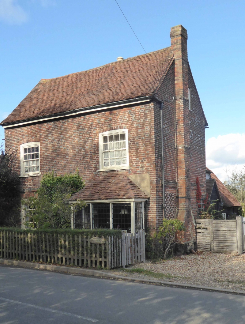
Entry Name: Chartridge Green House
Listing Date: 23 November 1983
Grade: II
Source: Historic England
Source ID: 1332484
English Heritage Legacy ID: 44631
ID on this website: 101332484
Location: Chartridge, Buckinghamshire, HP5
County: Buckinghamshire
Civil Parish: Chartridge
Built-Up Area: Chesham
Traditional County: Buckinghamshire
Lieutenancy Area (Ceremonial County): Buckinghamshire
Church of England Parish: Great Chesham
Church of England Diocese: Oxford
Tagged with: House
SP 90 SW CHARTRIDGE CHARTRIDGE
(north side)
5/29 Chartridge Green
House
-
GV II
House. C18 red brick, old tile roof. Two storeys, brick first floor
bands. Two double hung sash windows to each floor with flat arches.
Rear wing of painted brick with old tile roof, 2-storeys, older 1½-
storey section beyond with vestiges of timber framing.
Listing NGR: SP9306703819
External links are from the relevant listing authority and, where applicable, Wikidata. Wikidata IDs may be related buildings as well as this specific building. If you want to add or update a link, you will need to do so by editing the Wikidata entry.


Other nearby listed buildings
