Approximate Location Map
Large Map »
Latitude: 50.7206 / 50°43'14"N
Longitude: -3.5348 / 3°32'5"W
OS Eastings: 291753
OS Northings: 92347
OS Grid: SX917923
Mapcode National: GBR P0.Q4W0
Mapcode Global: FRA 37H5.LQ5
Plus Code: 9C2RPFC8+73
Entry Name: 118, Fore Street
Listing Date: 18 June 1974
Grade: II
Source: Historic England
Source ID: 1333363
English Heritage Legacy ID: 89087
ID on this website: 101333363
Location: Exeter, Devon, EX4
County: Devon
District: Exeter
Electoral Ward/Division: St David's
Parish: Non Civil Parish
Built-Up Area: Exeter
Traditional County: Devon
Lieutenancy Area (Ceremonial County): Devon
Church of England Parish: Exeter St Mary Steps
Church of England Diocese: Exeter
Tagged with: Building
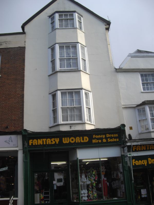
FORE STREET
1.
1092 (South-east side)
No 118
SX 9192 SE 5/163
II GV
2.
C18 gabled stucco front. Modern shop front. Splayed bays with C19 sash windows
on the three upper floors. Slate roof.
Nos 118 to 125 (consec) and Devonport Inn form a group.
Listing NGR: SX9175392347
External links are from the relevant listing authority and, where applicable, Wikidata. Wikidata IDs may be related buildings as well as this specific building. If you want to add or update a link, you will need to do so by editing the Wikidata entry.


Other nearby listed buildings
