Approximate Location Map
Large Map »
Latitude: 51.2813 / 51°16'52"N
Longitude: 1.0855 / 1°5'7"E
OS Eastings: 615278
OS Northings: 158094
OS Grid: TR152580
Mapcode National: GBR TY2.R7T
Mapcode Global: VHLGM.R2R3
Plus Code: 9F3373JP+G6
Entry Name: 1, Military Road
Listing Date: 7 September 1973
Grade: II
Source: Historic England
Source ID: 1334309
English Heritage Legacy ID: 439772
ID on this website: 101334309
Location: Northgate, Canterbury, Kent, CT1
County: Kent
District: Canterbury
Electoral Ward/Division: Northgate
Parish: Non Civil Parish
Built-Up Area: Canterbury
Traditional County: Kent
Lieutenancy Area (Ceremonial County): Kent
Tagged with: Building
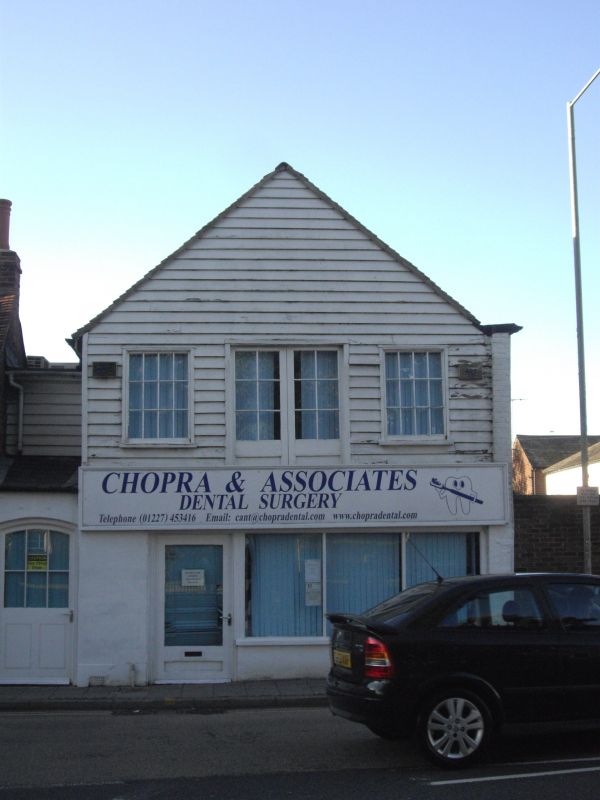
1.
944 MILITARY ROAD
(North West Side)
No 1
TR 1558 SW 3/431
II GV
2.
Formerly No 3.
An early C19 industrial building. 2 storeys weatherboarded with gable. Old
tiled roof. 2 sashes with wooden cills and trap door. Early C19 shop front.
Grade II for group value.
The listed buildings on the North-West Side of MIlitary Road form a group.
Listing NGR: TR1527558097
External links are from the relevant listing authority and, where applicable, Wikidata. Wikidata IDs may be related buildings as well as this specific building. If you want to add or update a link, you will need to do so by editing the Wikidata entry.


Other nearby listed buildings
