Approximate Location Map
Large Map »
Latitude: 52.2438 / 52°14'37"N
Longitude: 0.7131 / 0°42'47"E
OS Eastings: 585326
OS Northings: 264091
OS Grid: TL853640
Mapcode National: GBR QF0.73W
Mapcode Global: VHKD4.9VVS
Plus Code: 9F426PV7+G6
Entry Name: 10 and 10B, Whiting Street
Listing Date: 7 August 1952
Last Amended: 30 October 1997
Grade: II
Source: Historic England
Source ID: 1334468
English Heritage Legacy ID: 467740
ID on this website: 101334468
Location: Bury St Edmunds, West Suffolk, IP33
County: Suffolk
District: West Suffolk
Civil Parish: Bury St Edmunds
Built-Up Area: Bury St Edmunds
Traditional County: Suffolk
Lieutenancy Area (Ceremonial County): Suffolk
Church of England Parish: Bury St Edmunds St Mary
Church of England Diocese: St.Edmundsbury and Ipswich
Tagged with: Building
BURY ST EDMUNDS
TL8564SW WHITING STREET
639-1/14/694 (East side)
07/08/52 Nos.10 AND 10B
(Formerly Listed as:
WHITING STREET
(East side)
No.10)
GV II
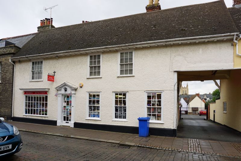
House, now with a shop on the ground storey and flat above.
C15/C16 with C18 front. Timber-framed and roughcast with a C20
tiled roof and mutule eaves soffit.
EXTERIOR: 2 storeys. 3 windows, irregularly spaced, to the
upper storey, all 16-pane sashes in flush cased frames. 3
similar windows to the right of the central entrance door and
a small-paned shop window on the left with a moulded
projecting frieze and cornice. The doorcase, with panelled
pilasters and an open pediment, has a C20 small-paned fully
glazed door.
A carriage entrance at the south end of the front has a small
section of framing exposed on the north side wall. At the rear
are 3 gabled wings, that on the right with a side jetty which
has the joist ends exposed.
INTERIOR: front range in 3 bays with partition walls removed.
On the left, the main beam is boxed in and there is a moulded
plaster cornice. On the right, the main beam has a very wide
chamfer and broach stops. An internal chimney-stack at the
rear of the left (north) end links with the jettied rear wing,
which has a heavy timber ceiling to the ground storey and the
remains of a fireplace with a timber lintel. Upper flat not
inspected.
Listing NGR: TL8532664091
External links are from the relevant listing authority and, where applicable, Wikidata. Wikidata IDs may be related buildings as well as this specific building. If you want to add or update a link, you will need to do so by editing the Wikidata entry.


Other nearby listed buildings
