Approximate Location Map
Large Map »
Latitude: 53.2028 / 53°12'10"N
Longitude: -1.5599 / 1°33'35"W
OS Eastings: 429493
OS Northings: 367393
OS Grid: SK294673
Mapcode National: GBR 584.8F8
Mapcode Global: WHCD9.0RGJ
Plus Code: 9C5W6C3R+42
Entry Name: Guidestone on Beeley Moor at Os 294674
Listing Date: 19 June 1987
Grade: II
Source: Historic England
Source ID: 1334716
English Heritage Legacy ID: 81594
ID on this website: 101334716
Location: Derbyshire Dales, Derbyshire, DE4
County: Derbyshire
District: Derbyshire Dales
Civil Parish: Beeley
Traditional County: Derbyshire
Lieutenancy Area (Ceremonial County): Derbyshire
Church of England Parish: Beeley St Anne
Church of England Diocese: Derby
Tagged with: Milestone
PARISH OF BEELEY BEELEY LANE
SK 26 NE
5/29
(North Side)
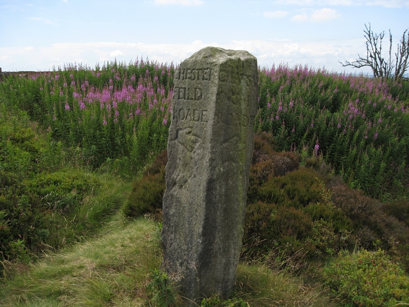
Guidestone on Beeley
Moor at OS 294674
II
Guide post. Possibly C18. Square gritstone post about three
feet tall. Much weathered. Inscribed OFFERTON ROADE,
CHESTERFIELD ROADE, CHATSWORTH ROADE AND BAKEWELL ROADE. Hands
with pointing fingers carved into each face.
Listing NGR: SK2949367392
External links are from the relevant listing authority and, where applicable, Wikidata. Wikidata IDs may be related buildings as well as this specific building. If you want to add or update a link, you will need to do so by editing the Wikidata entry.


