The listing was removed on 3 February 2020.
This building has been assessed for de-listing under the Planning (Listed Buildings and Conservation Areas) Act 1990 as amended. The building has been removed from The National Heritage List for England as it no longer meets the criteria for listing.
The information below has been retained for archive purposes. It does not necessarily reflect the current state of the building.
Latitude: 53.1896 / 53°11'22"N
Longitude: -1.6172 / 1°37'1"W
OS Eastings: 425674
OS Northings: 365898
OS Grid: SK256658
Mapcode National: GBR 587.5XR
Mapcode Global: WHCDG.4354
Plus Code: 9C5W59QM+R4
Entry Name: Rowsley Bridge
Listing Date: 12 July 1967
Delisted Date: 3 February 2020
Grade: II
Source: Historic England
Source ID: 1334757
English Heritage Legacy ID: 81734
ID on this website: 101334757
Location: Rowsley, Derbyshire Dales, Derbyshire, DE4
County: Derbyshire
District: Derbyshire Dales
Civil Parish: Rowsley
Traditional County: Derbyshire
Lieutenancy Area (Ceremonial County): Derbyshire
Church of England Parish: Rowsley St Katherine
Church of England Diocese: Derby
PARISH OF ROWSLEY BAKEWELL ROAD
SK 26 NE
5/167
12.7.67 Rowsley Bridge
II
Road bridge over the River Derwent. C15 and 1925-6. Sandstone
ashlar. To the east are four stepped pointed arches, ribbed
beneath. Triangular cutwaters between with steeply sloping
tops. Above the spandrels are eight cast iron oval ties.
Parapet walls rise slightly towards the middle and curve out at
the ends. Steeply chamfered copings. The bridge was widened to
the west in 1925-6 and has segmental arches and triangular
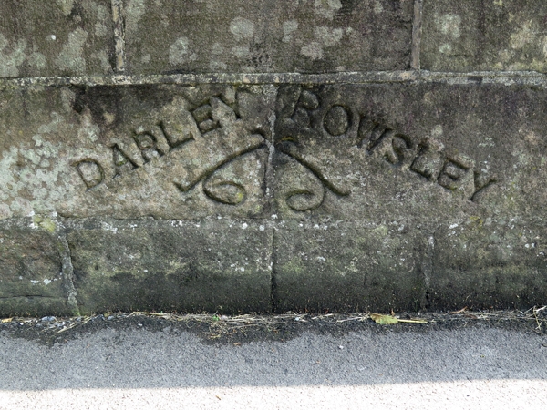
cutwaters. The parapet wall has a stone inscribed Rowsley
Bridge/ Widened 1925-6/ J W Horton, M Inst CE/ County Surveyor/
C F Tomlinson/ Contractor.
Listing NGR: SK2567465898
This text is from the original listing, and may not necessarily reflect the current setting of the building.


Other nearby listed buildings