Approximate Location Map
Large Map »
Latitude: 51.1772 / 51°10'37"N
Longitude: 0.7562 / 0°45'22"E
OS Eastings: 592746
OS Northings: 145609
OS Grid: TQ927456
Mapcode National: GBR RWC.00Q
Mapcode Global: VHKKD.2N3X
Plus Code: 9F325QG4+VF
Entry Name: Tollgate House
Listing Date: 14 February 1967
Last Amended: 10 October 1980
Grade: II
Source: Historic England
Source ID: 1335823
English Heritage Legacy ID: 181109
ID on this website: 101335823
Location: Pluckley, Ashford, Kent, TN27
County: Kent
District: Ashford
Civil Parish: Pluckley
Built-Up Area: Pluckley Thorne
Traditional County: Kent
Lieutenancy Area (Ceremonial County): Kent
Tagged with: House
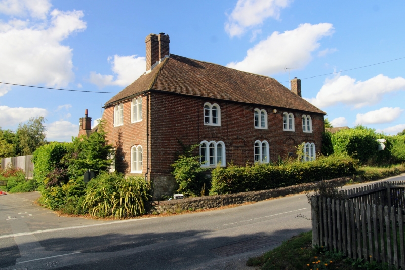
1.
5272 PLUCKLEY SHIPLAND CORNER
Tollgate House
(formerly listed as
Shipland Farm House)
TQ 9245 27/16 14.2.67.
II
2.
C18. Two storeys red brick on a stone base. Hipped tiled roof. Four Dering
windows, with brick cambered head linings above tile round-headed lights, with
keyblocks at the angles and in the centre of the heads.
Listing NGR: TQ9274645609
External links are from the relevant listing authority and, where applicable, Wikidata. Wikidata IDs may be related buildings as well as this specific building. If you want to add or update a link, you will need to do so by editing the Wikidata entry.


Other nearby listed buildings
