Approximate Location Map
Large Map »
Latitude: 51.3383 / 51°20'17"N
Longitude: 1.4234 / 1°25'24"E
OS Eastings: 638536
OS Northings: 165476
OS Grid: TR385654
Mapcode National: GBR X0M.0P1
Mapcode Global: VHMCW.MMBF
Plus Code: 9F338CQF+88
Entry Name: 22, Hereson Road
Listing Date: 4 February 1988
Grade: II
Source: Historic England
Source ID: 1336673
English Heritage Legacy ID: 171797
ID on this website: 101336673
Location: Ramsgate, Thanet, Kent, CT11
County: Kent
District: Thanet
Civil Parish: Ramsgate
Built-Up Area: Ramsgate
Traditional County: Kent
Lieutenancy Area (Ceremonial County): Kent
Tagged with: Building
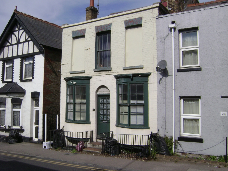
RAMSGATE HERESON ROAD
TR 3865 SE
(north-west side)
10/168 No. 22
GV II
House and shop. 1830's. Stock brick and slate roof. Two storeys and
basement with parapet and stack to right. Central sash with vertical
glazing bars and flanking blank window spaces on first floor, and 2
shallow bows on ground floor with glazing bar sashes. Central glazed door
with 2 steps. Basement openings to left and to right.
Listing NGR: TR3853665476
External links are from the relevant listing authority and, where applicable, Wikidata. Wikidata IDs may be related buildings as well as this specific building. If you want to add or update a link, you will need to do so by editing the Wikidata entry.


Other nearby listed buildings
