Approximate Location Map
Large Map »
Latitude: 51.2817 / 51°16'53"N
Longitude: 1.0847 / 1°5'5"E
OS Eastings: 615220
OS Northings: 158132
OS Grid: TR152581
Mapcode National: GBR TY2.R13
Mapcode Global: VHLGM.R19T
Plus Code: 9F3373JM+MV
Entry Name: St Crispin's
Listing Date: 3 May 1967
Grade: II
Source: Historic England
Source ID: 1336785
English Heritage Legacy ID: 170425
ID on this website: 101336785
Location: Northgate, Canterbury, Kent, CT1
County: Kent
District: Canterbury
Electoral Ward/Division: Northgate
Parish: Non Civil Parish
Built-Up Area: Canterbury
Traditional County: Kent
Lieutenancy Area (Ceremonial County): Kent
Tagged with: Architectural structure
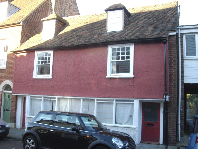
1.
944 BROAD STREET
(North East Side)
No 57
(St Crispin's)
TR 1558 SW 3/293 3.5.67.
II
2.
A timber-framed buUding, greatly restored. 2 storeys colour washed. Tiled
roof. 2 sashes with glazing bars intact. Traces of overhang. The groun
d floor has been entirely restored with a continuous window. 2 modern doorcases.
Listing NGR: TR1522358134
External links are from the relevant listing authority and, where applicable, Wikidata. Wikidata IDs may be related buildings as well as this specific building. If you want to add or update a link, you will need to do so by editing the Wikidata entry.


Other nearby listed buildings
