Approximate Location Map
Large Map »
Latitude: 51.2795 / 51°16'46"N
Longitude: 1.0799 / 1°4'47"E
OS Eastings: 614897
OS Northings: 157875
OS Grid: TR148578
Mapcode National: GBR TY2.PW3
Mapcode Global: VHLGM.N3SH
Plus Code: 9F3373HH+QX
Entry Name: 10, Guildhall Street
Listing Date: 7 September 1973
Grade: II
Source: Historic England
Source ID: 1336843
English Heritage Legacy ID: 170624
ID on this website: 101336843
Location: Canterbury, Kent, CT1
County: Kent
District: Canterbury
Electoral Ward/Division: Westgate
Parish: Non Civil Parish
Built-Up Area: Canterbury
Traditional County: Kent
Lieutenancy Area (Ceremonial County): Kent
Tagged with: Building
1.
944 GUILDHALL STREET
No 10
TR 1457 NE 4/502
II GV
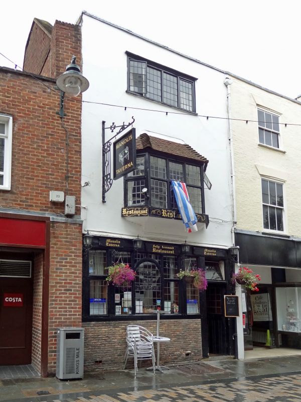
2.
C17 to C18. 3 storeys colourwashed. Restored tiled roof and parapet. 2nd
floor has 1 continuous casement. 1st floor mullioned and transomed bay.
Ground floor later shop front. Grade II for group value.
Nos 1 to 10 (consec) form a group.
Listing NGR: TR1489757875
External links are from the relevant listing authority and, where applicable, Wikidata. Wikidata IDs may be related buildings as well as this specific building. If you want to add or update a link, you will need to do so by editing the Wikidata entry.


Other nearby listed buildings
