Approximate Location Map
Large Map »
Latitude: 51.3613 / 51°21'40"N
Longitude: 1.0248 / 1°1'29"E
OS Eastings: 610675
OS Northings: 166813
OS Grid: TR106668
Mapcode National: GBR TX1.MWH
Mapcode Global: VHKJR.Q13R
Plus Code: 9F33926F+GW
Entry Name: 16, Harbour Street
Listing Date: 20 May 1977
Grade: II
Source: Historic England
Source ID: 1336881
English Heritage Legacy ID: 170826
ID on this website: 101336881
Location: Whitstable, Canterbury, Kent, CT5
County: Kent
District: Canterbury
Electoral Ward/Division: Gorrell
Parish: Non Civil Parish
Built-Up Area: Whitstable
Traditional County: Kent
Lieutenancy Area (Ceremonial County): Kent
Tagged with: Building
1.
5273
TR 1066 NE
1/97
HARBOUR STREET
(North-West Side)
No 16
II
GV
2.
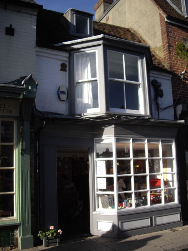
Late C17 or early C18 brick built building of 2 storeys with attic. Old clay tiled
roof. 1 dormer window, cant bay window 1st floor and early C19 cant shop window
ground floor.
Listing NGR: TR1067566813
External links are from the relevant listing authority and, where applicable, Wikidata. Wikidata IDs may be related buildings as well as this specific building. If you want to add or update a link, you will need to do so by editing the Wikidata entry.


Other nearby listed buildings
