Approximate Location Map
Large Map »
Latitude: 51.0932 / 51°5'35"N
Longitude: 0.5233 / 0°31'23"E
OS Eastings: 576790
OS Northings: 135684
OS Grid: TQ767356
Mapcode National: GBR PTC.F39
Mapcode Global: FRA C6Z7.HNW
Plus Code: 9F323GVF+78
Entry Name: The Cottage
Listing Date: 19 May 1986
Grade: II
Source: Historic England
Source ID: 1336912
English Heritage Legacy ID: 168978
ID on this website: 101336912
Location: Cranbrook, Tunbridge Wells, Kent, TN17
County: Kent
District: Tunbridge Wells
Civil Parish: Cranbrook & Sissinghurst
Built-Up Area: Cranbrook
Traditional County: Kent
Lieutenancy Area (Ceremonial County): Kent
Tagged with: Cottage
CRANBROOK HARTLEY ROAD
TQ 73 NE
(south side)
3/130
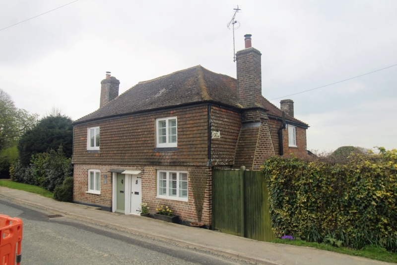
- The Cottage
GV II
Cottage pair, now one. C18. Timber framed and clad in red brick on ground
floor and tile hung on first floor. Plain tiled hipped roof with projecting
end stacks. 2 storeys. Regular 2 window front, with casements, to left on
ground floor under segment head, and to right iron-framed. Paired boarded
doors in centre with small pentice hoods over.
Listing NGR: TQ7660935341
External links are from the relevant listing authority and, where applicable, Wikidata. Wikidata IDs may be related buildings as well as this specific building. If you want to add or update a link, you will need to do so by editing the Wikidata entry.


Other nearby listed buildings
