Approximate Location Map
Large Map »
Latitude: 51.1354 / 51°8'7"N
Longitude: 0.262 / 0°15'43"E
OS Eastings: 558354
OS Northings: 139778
OS Grid: TQ583397
Mapcode National: GBR MPS.M34
Mapcode Global: VHHQD.HQCH
Plus Code: 9F3247P6+5R
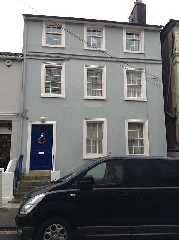
Entry Name: 5, Hanover Road
Listing Date: 7 June 1974
Grade: II
Source: Historic England
Source ID: 1338806
English Heritage Legacy ID: 168016
ID on this website: 101338806
Location: Royal Tunbridge Wells, Tunbridge Wells, Kent, TN1
County: Kent
District: Tunbridge Wells
Electoral Ward/Division: Culverden
Parish: Non Civil Parish
Built-Up Area: Royal Tunbridge Wells
Traditional County: Kent
Lieutenancy Area (Ceremonial County): Kent
Church of England Parish: Tunbridge Wells St John
Church of England Diocese: Rochester
Tagged with: Building
HANOVER ROAD
1.
1746
(North West Side)
No 5
TQ 5839 NW 3/212
II GV
2.
Mid C19. 3 storeys and basement stuccoed. Slate roof. 3 sashes set in
moulded architraves. Left side doorcase with moulded architrave and 6
panelled door. Steps to street. Plinth.
Nos 1 to 8 (consec) form a group.
Listing NGR: TQ5835439778
External links are from the relevant listing authority and, where applicable, Wikidata. Wikidata IDs may be related buildings as well as this specific building. If you want to add or update a link, you will need to do so by editing the Wikidata entry.


Other nearby listed buildings
