Approximate Location Map
Large Map »
Latitude: 51.1545 / 51°9'16"N
Longitude: -0.959 / 0°57'32"W
OS Eastings: 472903
OS Northings: 139981
OS Grid: SU729399
Mapcode National: GBR C9B.JCX
Mapcode Global: VHDYC.B7DV
Plus Code: 9C3X523R+QC
Entry Name: Anstey Mill
Listing Date: 31 March 1977
Grade: II
Source: Historic England
Source ID: 1338919
English Heritage Legacy ID: 141746
ID on this website: 101338919
Location: Anstey, East Hampshire, GU34
County: Hampshire
District: East Hampshire
Civil Parish: Alton
Built-Up Area: Alton
Traditional County: Hampshire
Lieutenancy Area (Ceremonial County): Hampshire
Church of England Parish: The Resurrection Alton
Church of England Diocese: Winchester
Tagged with: Mill
ANSTEY MILL LANE
1.
5236
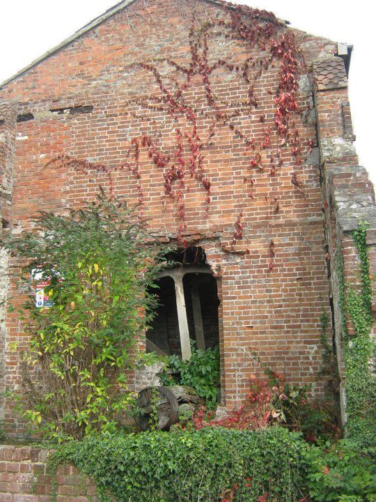
Anstey Mill
SU 7239 3/13
II GV
2.
C19, and now almost completely in ruins, though still with its big iron waterwheel
more or less in place. Coursed stone; brick dressings.
Anstey Mill and Nos 1 and 2 form a group.
Listing NGR: SU7272240289
External links are from the relevant listing authority and, where applicable, Wikidata. Wikidata IDs may be related buildings as well as this specific building. If you want to add or update a link, you will need to do so by editing the Wikidata entry.


Other nearby listed buildings
