Approximate Location Map
Large Map »
Latitude: 50.9069 / 50°54'24"N
Longitude: -1.4012 / 1°24'4"W
OS Eastings: 442197
OS Northings: 112106
OS Grid: SU421121
Mapcode National: GBR RR2.FZ
Mapcode Global: FRA 76YQ.3XL
Plus Code: 9C2WWH4X+QG
Entry Name: 32, Palmerston Road
Listing Date: 14 February 1969
Grade: II
Source: Historic England
Source ID: 1339991
English Heritage Legacy ID: 135877
ID on this website: 101339991
Location: Kingsland Place, Southampton, Hampshire, SO14
County: City of Southampton
Electoral Ward/Division: Bargate
Parish: Non Civil Parish
Built-Up Area: Southampton
Traditional County: Hampshire
Lieutenancy Area (Ceremonial County): Hampshire
Church of England Parish: Southampton City Centre St Mary
Church of England Diocese: Winchester
Tagged with: Building
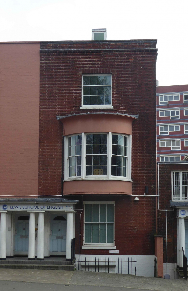
1. PALMERSTON ROAD
5239
No 32
SU 4212 2/185 14.2.69
II GV
2.
Early C19. Three storeys red brick. Slate roof. Parapet. One sash, including
a 3-light curved bow to first floor. Tuscan portico. Rear elevation faced
with Deveonshire slates.
Listing NGR: SU4220212108
External links are from the relevant listing authority and, where applicable, Wikidata. Wikidata IDs may be related buildings as well as this specific building. If you want to add or update a link, you will need to do so by editing the Wikidata entry.


Other nearby listed buildings
