Approximate Location Map
Large Map »
Latitude: 51.3739 / 51°22'26"N
Longitude: 1.3092 / 1°18'33"E
OS Eastings: 630411
OS Northings: 169069
OS Grid: TR304690
Mapcode National: GBR WZW.V41
Mapcode Global: VHLG5.NQ0M
Plus Code: 9F3398F5+HM
Entry Name: 199, Canterbury Road
Listing Date: 22 February 1973
Grade: II
Source: Historic England
Source ID: 1341506
English Heritage Legacy ID: 356492
ID on this website: 101341506
Location: Birchington, Thanet, Kent, CT7
County: Kent
District: Thanet
Civil Parish: Birchington
Built-Up Area: Margate
Traditional County: Kent
Lieutenancy Area (Ceremonial County): Kent
Tagged with: Building
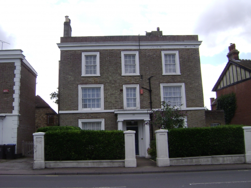
CANTERBURY ROAD
1.
1380
(South Side)
BIRCHINGTON-ON-SEA
No 199
TR 36 nw 9/111
II
2.
Mid C19. 3 storeys brown brick. Parapet and dropped moulded eaves cornice.
3 sashes set in moulded architraves with glazing bars intact. Stringcourse.
The ground floor has a Doric portico with 2 fluted columns and 2 pilasters,
rectangular fanlight and panelled reveals.
Listing NGR: TR3041169069
External links are from the relevant listing authority and, where applicable, Wikidata. Wikidata IDs may be related buildings as well as this specific building. If you want to add or update a link, you will need to do so by editing the Wikidata entry.


Other nearby listed buildings
