Approximate Location Map
Large Map »
Latitude: 52.4094 / 52°24'34"N
Longitude: -1.6423 / 1°38'32"W
OS Eastings: 424428
OS Northings: 279109
OS Grid: SP244791
Mapcode National: GBR 5KH.ZJ9
Mapcode Global: VHBWW.HP4S
Plus Code: 9C4WC955+Q3
Entry Name: Berks Well
Listing Date: 22 July 1976
Grade: II
Source: Historic England
Source ID: 1343252
English Heritage Legacy ID: 218104
ID on this website: 101343252
Location: Berkswell, Solihull, West Midlands, CV7
County: Solihull
Civil Parish: Berkswell
Traditional County: Warwickshire
Lieutenancy Area (Ceremonial County): West Midlands
Church of England Parish: Berkswell St John the Baptist
Church of England Diocese: Coventry
Tagged with: Well
BERKSWELL CHURCH LANE
1.
5108
(South-West Side)
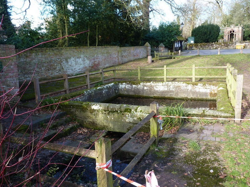
Berks Well
SP 2479 19/232
II
2.
Open sunk basin, ashlar lined, 16 feet square with smaller rectangular basin adjoining on south. ? a watering trough for animals. C18 or earlier.
Listing NGR: SP2442879109
External links are from the relevant listing authority and, where applicable, Wikidata. Wikidata IDs may be related buildings as well as this specific building. If you want to add or update a link, you will need to do so by editing the Wikidata entry.


Other nearby listed buildings
