Approximate Location Map
Large Map »
Latitude: 51.2233 / 51°13'23"N
Longitude: 1.403 / 1°24'10"E
OS Eastings: 637711
OS Northings: 152624
OS Grid: TR377526
Mapcode National: GBR X1Y.7JQ
Mapcode Global: VHMDG.8JK2
Plus Code: 9F336CF3+85
Entry Name: New Inn
Listing Date: 8 February 1974
Grade: II
Source: Historic England
Source ID: 1343691
English Heritage Legacy ID: 177113
Also known as: The New Inn, Deal
ID on this website: 101343691
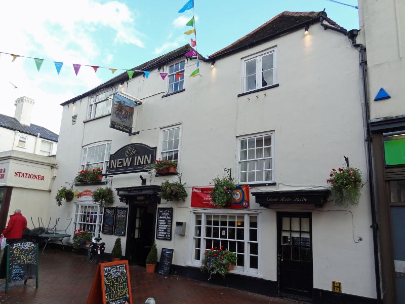
HIGH STREET
1.
1035
(East Side)
No 32
TR 3752 NE 1/103 (New Inn)
II
2.
C18. 3 storeys stuccoed. Hipped tiled roof. 3 sashes, 1 of which is 3 light
with a cambered head. Modern doorcase.
Listing NGR: TR3771152624
External links are from the relevant listing authority and, where applicable, Wikidata. Wikidata IDs may be related buildings as well as this specific building. If you want to add or update a link, you will need to do so by editing the Wikidata entry.


Other nearby listed buildings
