Approximate Location Map
Large Map »
Latitude: 51.7484 / 51°44'54"N
Longitude: -0.338 / 0°20'16"W
OS Eastings: 514832
OS Northings: 206828
OS Grid: TL148068
Mapcode National: GBR H89.CCS
Mapcode Global: VHGPQ.3B51
Plus Code: 9C3XPMX6+9R
Entry Name: 71, Sopwell Lane
Listing Date: 27 August 1971
Grade: II
Source: Historic England
Source ID: 1347168
English Heritage Legacy ID: 163450
ID on this website: 101347168
Location: St Albans, St. Albans, Hertfordshire, AL1
County: Hertfordshire
District: St. Albans
Electoral Ward/Division: St Peters
Parish: Non Civil Parish
Built-Up Area: St Albans
Traditional County: Hertfordshire
Lieutenancy Area (Ceremonial County): Hertfordshire
Church of England Parish: Abbey Parish of St Albans
Church of England Diocese: St.Albans
Tagged with: Building
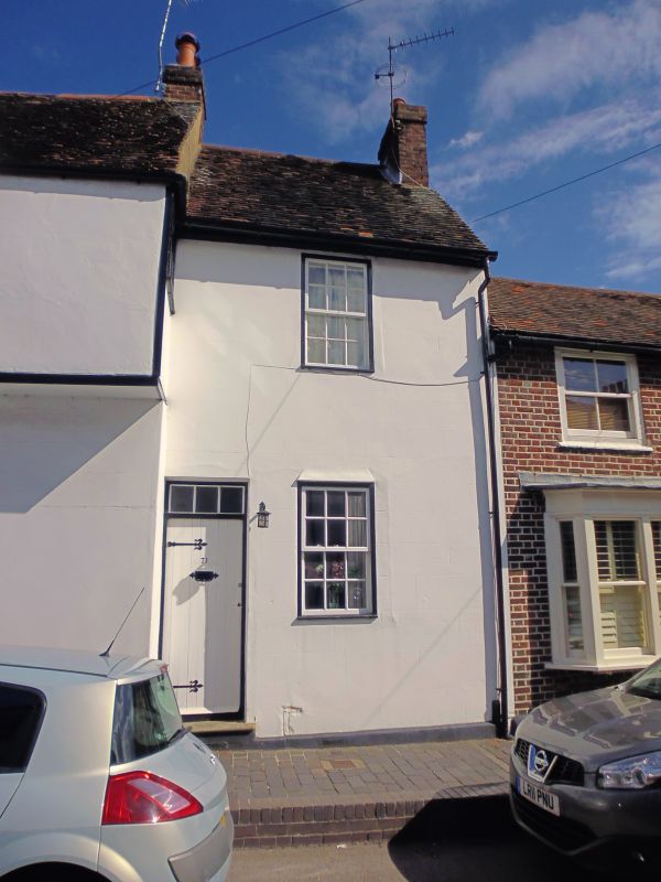
SOPWELL LANE
1. (North Side)
1582
No 71
TL 1406 NE 14/289
II GV
2.
Early C18. 2 storeys, one window. High pitched, tiled roof. Rendered
front. Replaced door. 1st floor sash window in near-flush frame. Ground
floor window replaced.
Nos 63 to 75 odd form a group.
Listing NGR: TL1483206828
External links are from the relevant listing authority and, where applicable, Wikidata. Wikidata IDs may be related buildings as well as this specific building. If you want to add or update a link, you will need to do so by editing the Wikidata entry.
Other nearby listed buildings


