Approximate Location Map
Large Map »
Latitude: 52.1664 / 52°9'59"N
Longitude: -2.2151 / 2°12'54"W
OS Eastings: 385387
OS Northings: 252039
OS Grid: SO853520
Mapcode National: GBR 1GJ.4SY
Mapcode Global: VH92T.KTB2
Plus Code: 9C4V5Q8M+HX
Entry Name: Timberdine Farmhouse
Listing Date: 5 July 1955
Grade: II
Source: Historic England
Source ID: 1350426
English Heritage Legacy ID: 147297
ID on this website: 101350426
Location: St Peter the Great, Worcester, Worcestershire, WR5
County: Worcestershire
District: Worcester
Civil Parish: St. Peter the Great County
Built-Up Area: Worcester
Traditional County: Worcestershire
Lieutenancy Area (Ceremonial County): Worcestershire
Church of England Parish: Worcester St Mark-in-the-Cherry Orchard
Church of England Diocese: Worcester
Tagged with: Farmhouse
ST PETER THE GREAT COUNTY -
SO 85 SE
4/756 Timberdine Farmhouse
5.7.55
GV II
SO 85 SE ST PETER THE GREAT COUNTY -
4/605 Timberdine Farmhouse
5.7.55
GV II
------------------------------------
ST PETER THE GREAT COUNTY CP -
SO 85 SE
Timberdine Farmhouse
4/756
5.7.55
GV II
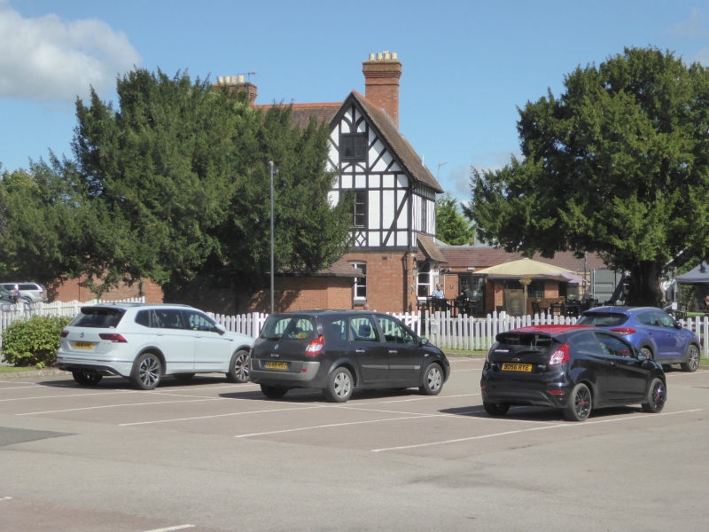
Farmhouse, now public house. C16 with late C19 and late C20 alterations and
additions. Timber-frame with some brick and some wattle-and-daub infill. H-
plan, C16 floored hall range aligned east/west; west cross-wing C19, east cross-
wing two framed bays, C16. North front: gabled and jettied two-storey wing to
left with two 2-light casements to first floor and a 3-light casement to ground
floor; hall range: 3-light casement to first floor, three 2- and 3-light casements
to ground floor; right cross-wing two storeys with gable lit attic, 2-light case-
ment to both floors, simulated timber-framing to first floor. Framing: left cross-
wing close-studded with mid-rail to each floor; roof trusses have tie-beam and
arch braced collar; hall range close-studded with mid-rail, on the first floor
above the rail the framing is square panels, two high. Undergoing conversion
to public house at time of the survey (December 1984).
Listing NGR: SO8619552482
External links are from the relevant listing authority and, where applicable, Wikidata. Wikidata IDs may be related buildings as well as this specific building. If you want to add or update a link, you will need to do so by editing the Wikidata entry.


Other nearby listed buildings
