Approximate Location Map
Large Map »
Latitude: 51.0674 / 51°4'2"N
Longitude: -1.1857 / 1°11'8"W
OS Eastings: 457155
OS Northings: 130102
OS Grid: SU571301
Mapcode National: GBR 97K.127
Mapcode Global: FRA 86D9.HWL
Plus Code: 9C3W3R87+XP
Entry Name: L Shaped Barn 20 Metres South East of Grange Farmhouse
Listing Date: 19 December 1983
Grade: II
Source: Historic England
Source ID: 1350433
English Heritage Legacy ID: 145536
ID on this website: 101350433
Location: Tichborne, Winchester, Hampshire, SO24
County: Hampshire
District: Winchester
Civil Parish: Tichborne
Traditional County: Hampshire
Lieutenancy Area (Ceremonial County): Hampshire
Church of England Parish: Tichborne St Andrew
Church of England Diocese: Winchester
Tagged with: Barn
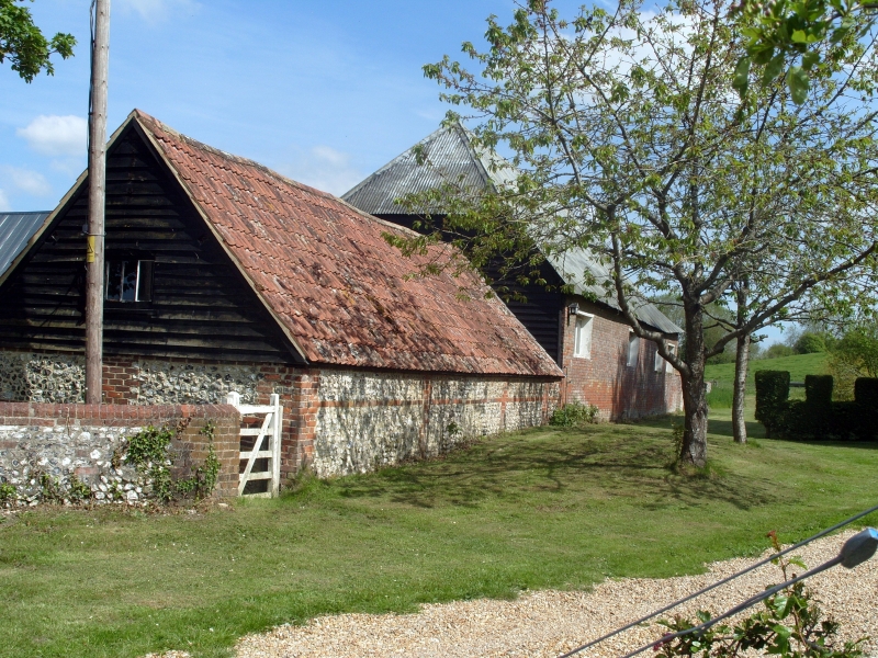
SU 5730 TICHBORNE TICHBORNE
10/19 L-shaped Barn 20m SE
of Grange Farmhouse
GV II
L-shaped pair of barns. C16 or C17. Timber-frame clad in weatherboarding and
corrugated iron, with iron roof, but side facing farmhouse refronted in brick.
Range parallel to house, 6 narrow bays, with behind it larger 6 bay barn, all of
same period of construction. The former has open end to addition at hipped end
where other barn joins it on side. Doors at half-hipped other end. Main barn
has aisles, midstray doors in bay adjacent to smaller barn, facing away from
courtyard and midstrey on both sides 4 bays along, these being C18. Gable end
of this barn has been rebuilt. Inside roof construction double tier of tie
with braces supporting, near each end, post to lower purlin with on both sides
curves braces to purlin and on top of tie between purlins a queen post truss which supports upper purlin which has windbracing to rafters. Aisled large barn has posts on plates on brick plinths, side tie, but no passing brace.
Listing NGR: SU5715530102
External links are from the relevant listing authority and, where applicable, Wikidata. Wikidata IDs may be related buildings as well as this specific building. If you want to add or update a link, you will need to do so by editing the Wikidata entry.


Other nearby listed buildings
