Approximate Location Map
Large Map »
Latitude: 50.9945 / 50°59'40"N
Longitude: -1.0322 / 1°1'55"W
OS Eastings: 468016
OS Northings: 122120
OS Grid: SU680221
Mapcode National: GBR B9V.HWD
Mapcode Global: FRA 86QH.3PN
Plus Code: 9C2WXXV9+Q4
Entry Name: Middle Barnards
Listing Date: 12 March 1986
Grade: II
Source: Historic England
Source ID: 1351124
English Heritage Legacy ID: 142882
ID on this website: 101351124
Location: East Meon, East Hampshire, GU32
County: Hampshire
District: East Hampshire
Civil Parish: East Meon
Built-Up Area: East Meon
Traditional County: Hampshire
Lieutenancy Area (Ceremonial County): Hampshire
Church of England Parish: East Meon All Saints
Church of England Diocese: Portsmouth
Tagged with: Architectural structure
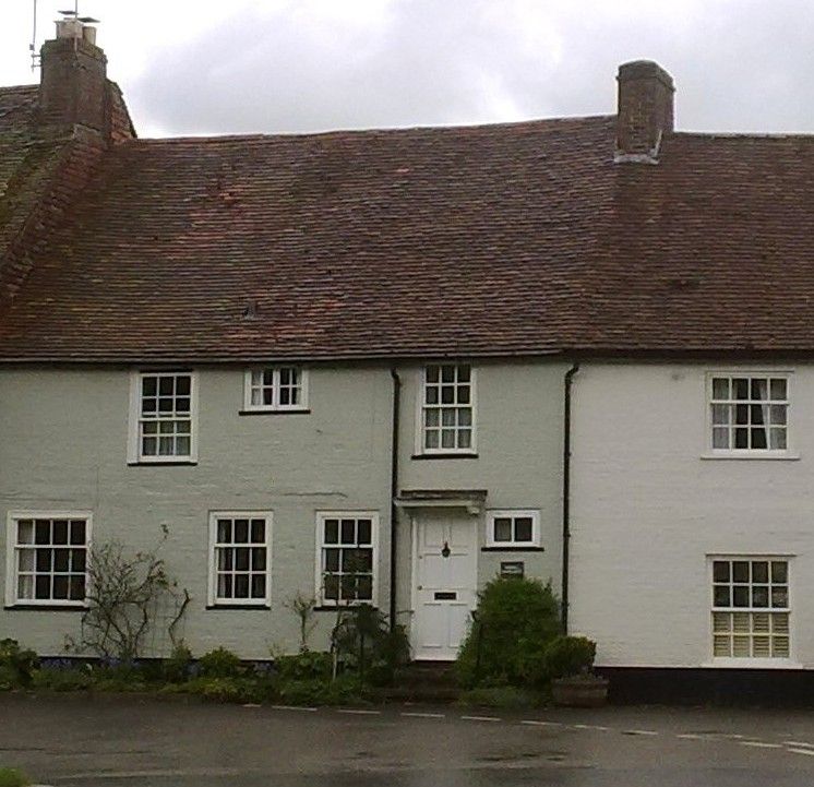
6822 EAST MEON HIGH STREET, South side
12/35 Middle Barnards
GV II
House, formerly two. C18. Painted brickwork in Flemish bond. Tile roof. North
front of two storeys three windows. Sashes in exposed frames, one upper and one
small lower casement. C20 Georgian doorway, with moulded hood on brackets.
Listing NGR: SU6801322120
External links are from the relevant listing authority and, where applicable, Wikidata. Wikidata IDs may be related buildings as well as this specific building. If you want to add or update a link, you will need to do so by editing the Wikidata entry.


Other nearby listed buildings
