Approximate Location Map
Large Map »
Latitude: 55.0096 / 55°0'34"N
Longitude: -1.4338 / 1°26'1"W
OS Eastings: 436309
OS Northings: 568482
OS Grid: NZ363684
Mapcode National: GBR LBFJ.D0
Mapcode Global: WHD4R.YBDX
Plus Code: 9C7W2H58+RF
Entry Name: Clifford's Fort Trinity House Almshouses and Boundary Stone Attached
Listing Date: 19 February 1986
Grade: II
Source: Historic England
Source ID: 1355016
English Heritage Legacy ID: 303382
ID on this website: 101355016
Location: North Shields, North Tyneside, Tyne and Wear, NE30
County: North Tyneside
Electoral Ward/Division: Tynemouth
Parish: Non Civil Parish
Built-Up Area: Tynemouth
Traditional County: Northumberland
Lieutenancy Area (Ceremonial County): Tyne and Wear
Church of England Parish: Tynemouth Priory Holy Saviour
Church of England Diocese: Newcastle
Tagged with: Architectural structure
TYNEMOUTH UNION ROAD (east side, off)
NZ 3668 SW
15/134 Clifford's Fort (No. 54)
Trinity House Almshouses
and boundary stone attached.
G.V. II
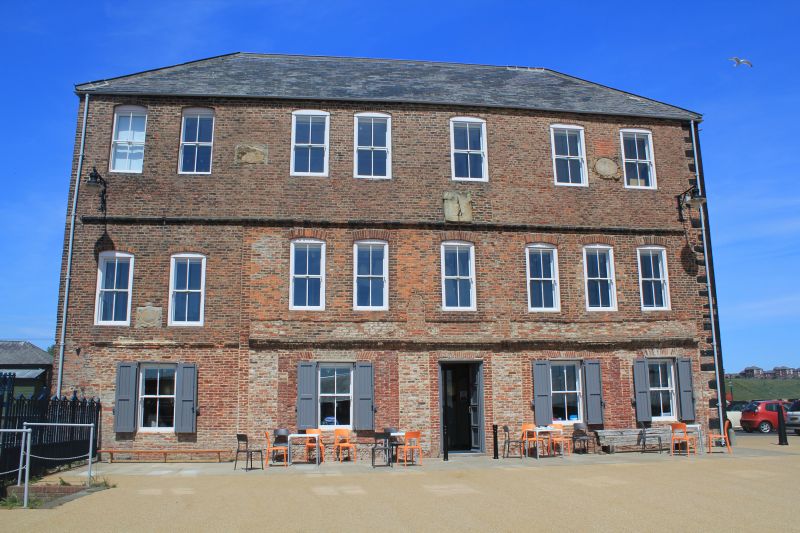
Lighthouse, later almshouse. 1727 lighthouse; raised 1775; converted to almshouses
1830; for Trinity House, Newcastle upon Tyne. Brick of varying bonds with quoins
at right; ground floor rendered; painted sandstone ashlar right return; sandstone
rubble lower courses on left return. Welsh slate roof. 3 storeys, 8 irregular bays.
Ground floor: rendered lintel to door in fifth bay, flat arches to windows.
Elliptical brick arches to windows on upper floors. Some windows bricked up, some
with sashes burnt or removed. Inserted double loading doors in first floor. Deep
moulded brick first floor string; moulded brick brackets to second floor band.
3 commemorative panels, eroded, on first and second floors, one latter dated
1775. Sundial on second floor, right of centre. Hipped roof without chimneys.
Historical note: Trinity House, Newcastle, was granted permission to build
leading lights at Shields by Henry VIII. This is the earliest survivor of
buildings begun in 1539; it became redundant on completion of the new low light
(q.v.) in 1808. Sources: Trinity House MSS. Boundary stone attached to left
return: sandstone block inscribed WD/BS/No7 about 12 cm. above ground. Almshouse
empty and derelict at time of survey.
Listing NGR: NZ3630968482
External links are from the relevant listing authority and, where applicable, Wikidata. Wikidata IDs may be related buildings as well as this specific building. If you want to add or update a link, you will need to do so by editing the Wikidata entry.


Other nearby listed buildings
