Approximate Location Map
Large Map »
Latitude: 51.524 / 51°31'26"N
Longitude: -1.7202 / 1°43'12"W
OS Eastings: 419510
OS Northings: 180605
OS Grid: SU195806
Mapcode National: GBR 4VX.HWG
Mapcode Global: VHC13.4YGK
Plus Code: 9C3WG7FH+JW
Entry Name: 28 and 29, Badbury
Listing Date: 20 September 1979
Grade: II
Source: Historic England
Source ID: 1355968
English Heritage Legacy ID: 318276
ID on this website: 101355968
Location: Badbury, Swindon, Wiltshire, SN4
County: Swindon
Civil Parish: Chiseldon
Traditional County: Wiltshire
Lieutenancy Area (Ceremonial County): Wiltshire
Tagged with: Building
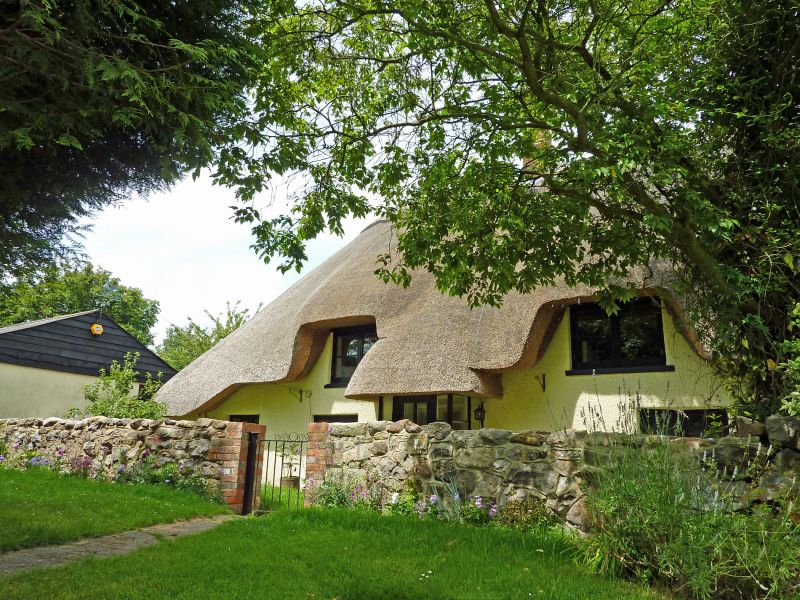
1.
5410 CHISELDON BADBURY
Nos 28 and 29
SU 18 SE 11/138
II GV
2.
C17 or early C18. Thatched former row. Pebble-dashed. Four eyebrows. Two
brick chimneys. Roof catslide at each gable end with one window, 4 windows
between, mostly pre-war casements, Two storey one bay slate roofed extension
to right. No 28 has porch to right. No 29 has thatched glazed porch.
Listing NGR: SU1951080605
External links are from the relevant listing authority and, where applicable, Wikidata. Wikidata IDs may be related buildings as well as this specific building. If you want to add or update a link, you will need to do so by editing the Wikidata entry.


Other nearby listed buildings
