Approximate Location Map
Large Map »
Latitude: 51.3167 / 51°19'0"N
Longitude: 0.8865 / 0°53'11"E
OS Eastings: 601248
OS Northings: 161470
OS Grid: TR012614
Mapcode National: GBR SW3.8ZP
Mapcode Global: VHKJW.B51F
Plus Code: 9F328V8P+MJ
Entry Name: 78, West Street
Listing Date: 3 August 1972
Grade: II
Source: Historic England
Source ID: 1356649
English Heritage Legacy ID: 438551
ID on this website: 101356649
Location: Davington, Swale, Kent, ME13
County: Kent
District: Swale
Civil Parish: Faversham
Built-Up Area: Faversham
Traditional County: Kent
Lieutenancy Area (Ceremonial County): Kent
Tagged with: Building
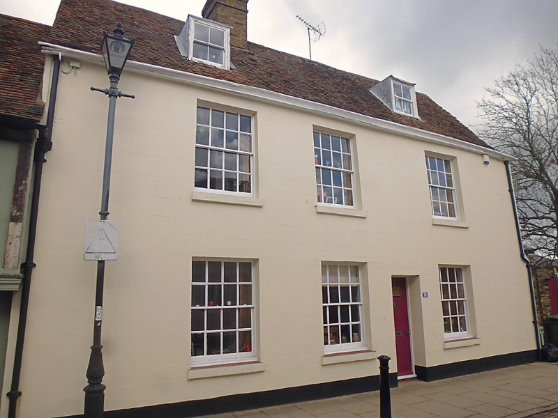
WEST STREET
1.
ll03 (North Side)
------------
No 78
TR O161 SW 2/127
II
2.
C17 refaced. Early C19. 2 storeys and attic. 3 windows. 2 dormers.
Stuccoed. Tiled roof. Glazing bars intact.
Listing NGR: TR0124861472
External links are from the relevant listing authority and, where applicable, Wikidata. Wikidata IDs may be related buildings as well as this specific building. If you want to add or update a link, you will need to do so by editing the Wikidata entry.


Other nearby listed buildings
