Approximate Location Map
Large Map »
Latitude: 51.3162 / 51°18'58"N
Longitude: 0.89 / 0°53'23"E
OS Eastings: 601489
OS Northings: 161418
OS Grid: TR014614
Mapcode National: GBR SW3.HTD
Mapcode Global: VHKJW.C5VV
Plus Code: 9F328V8Q+FX
Entry Name: 114, West Street
Listing Date: 3 August 1972
Grade: II
Source: Historic England
Source ID: 1356689
English Heritage Legacy ID: 438561
ID on this website: 101356689
Location: Faversham, Swale, Kent, ME13
County: Kent
District: Swale
Civil Parish: Faversham
Built-Up Area: Faversham
Traditional County: Kent
Lieutenancy Area (Ceremonial County): Kent
Tagged with: Building
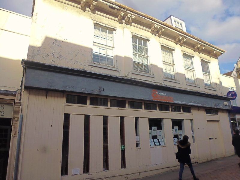
WEST STREET
1.
l103 (North Side)
------------
No 114
TR 0161W 2/136
II GV
2.
Large Cl7 house. 2 storeys and attic. 5 windows. 2 dormers.
Stuccoed. Wide eaves cornice with carved brackets. Tiled roof.
Glazing bars intact. Modern shop front. Photograph in NMR.
Nos 114 to 117 (consec) form a group.
Listing NGR: TR0149161422
External links are from the relevant listing authority and, where applicable, Wikidata. Wikidata IDs may be related buildings as well as this specific building. If you want to add or update a link, you will need to do so by editing the Wikidata entry.


Other nearby listed buildings
