Approximate Location Map
Large Map »
Latitude: 51.2826 / 51°16'57"N
Longitude: 1.0819 / 1°4'54"E
OS Eastings: 615017
OS Northings: 158234
OS Grid: TR150582
Mapcode National: GBR TY2.JBM
Mapcode Global: VHLGM.P1T1
Plus Code: 9F3373MJ+3Q
Entry Name: 16, St Radigund Street
Listing Date: 7 September 1973
Grade: II
Source: Historic England
Source ID: 1357524
English Heritage Legacy ID: 443274
ID on this website: 101357524
Location: Northgate, Canterbury, Kent, CT1
County: Kent
District: Canterbury
Electoral Ward/Division: Westgate
Parish: Non Civil Parish
Built-Up Area: Canterbury
Traditional County: Kent
Lieutenancy Area (Ceremonial County): Kent
Tagged with: Building
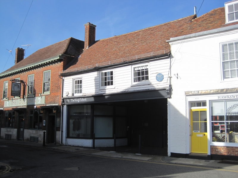
1.
944 ST RADIGUND STREET
(North Side)
No 16
TR 1558 SW 3/699
II GV
2.
An C18 industrial building. 2 storeys weatherboarded with brick ground floor.
Old tiled roof. 3 sashes with glazing bars intact. Later shop front.
Nos 5 to 13 (consec), Nos 15 and 16 form a group.
Listing NGR: TR1501358262
External links are from the relevant listing authority and, where applicable, Wikidata. Wikidata IDs may be related buildings as well as this specific building. If you want to add or update a link, you will need to do so by editing the Wikidata entry.


Other nearby listed buildings
