Approximate Location Map
Large Map »
Latitude: 51.521 / 51°31'15"N
Longitude: -0.0491 / 0°2'56"W
OS Eastings: 535448
OS Northings: 182040
OS Grid: TQ354820
Mapcode National: GBR J8.Y0J
Mapcode Global: VHGR1.31D9
Plus Code: 9C3XGXC2+C9
Entry Name: 166, Mile End Road E1
Listing Date: 27 September 1973
Grade: II
Source: Historic England
Source ID: 1357869
English Heritage Legacy ID: 206093
ID on this website: 101357869
Location: Stepney, Tower Hamlets, London, E1
County: London
District: Tower Hamlets
Electoral Ward/Division: St Dunstan's
Parish: Non Civil Parish
Built-Up Area: Tower Hamlets
Traditional County: Middlesex
Lieutenancy Area (Ceremonial County): Greater London
Church of England Parish: St Dunstan Stepney
Church of England Diocese: London
Tagged with: Building
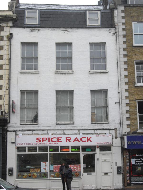
MILE END ROAD E1
1.
4431
(South Side)
No 166
TQ 3582 10/911
II
2.
Early C19. Painted brick with parapet. 3 storeys and dormers. 3 windows, sashes
with glazing bars. Modern shop front.
Listing NGR: TQ3544882040
External links are from the relevant listing authority and, where applicable, Wikidata. Wikidata IDs may be related buildings as well as this specific building. If you want to add or update a link, you will need to do so by editing the Wikidata entry.


Other nearby listed buildings
