Approximate Location Map
Large Map »
Latitude: 51.393 / 51°23'34"N
Longitude: 0.1148 / 0°6'53"E
OS Eastings: 547229
OS Northings: 168119
OS Grid: TQ472681
Mapcode National: GBR QF.3LP
Mapcode Global: VHHP4.Y71Y
Plus Code: 9F3294V7+6W
Entry Name: Durley House
Listing Date: 29 June 1973
Grade: II
Source: Historic England
Source ID: 1359328
English Heritage Legacy ID: 358489
ID on this website: 101359328
Location: St Mary Cray, Bromley, London, BR5
County: London
District: Bromley
Electoral Ward/Division: Cray Valley East
Parish: Non Civil Parish
Built-Up Area: Bromley
Traditional County: Kent
Lieutenancy Area (Ceremonial County): Greater London
Church of England Parish: Cray Valley
Church of England Diocese: Rochester
Tagged with: House
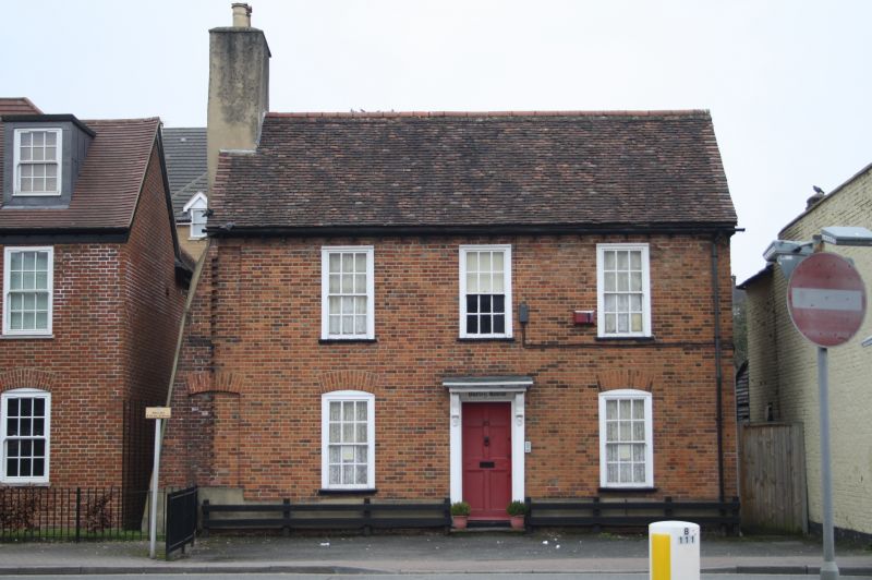
HIGH STREET, ST MARY CRAY
1.
4407 (East Side)
No 83 (Durley House)
TQ 45 NE 9/200
II
2.
C18. 2 storeys. Red brick. Tiled roof with wooden dentil eaves cornice.
3 windows with glazing bars intact. Ground floor cambered arches. Doorcase
with moulded architrave and brackets. Door of 6 moulded panels.
Listing NGR: TQ4036469136
External links are from the relevant listing authority and, where applicable, Wikidata. Wikidata IDs may be related buildings as well as this specific building. If you want to add or update a link, you will need to do so by editing the Wikidata entry.


Other nearby listed buildings
