Approximate Location Map
Large Map »
Latitude: 52.6508 / 52°39'2"N
Longitude: -0.4861 / 0°29'10"W
OS Eastings: 502510
OS Northings: 306974
OS Grid: TF025069
Mapcode National: GBR FVR.XJW
Mapcode Global: WHGLX.HMQP
Plus Code: 9C4XMG27+8G
Entry Name: Bastion
Listing Date: 22 May 1954
Grade: I
Source: Historic England
Source ID: 1360072
English Heritage Legacy ID: 193863
ID on this website: 101360072
Location: Stamford, South Kesteven, Lincolnshire, PE9
County: Lincolnshire
District: South Kesteven
Civil Parish: Stamford
Built-Up Area: Stamford
Traditional County: Lincolnshire
Lieutenancy Area (Ceremonial County): Lincolnshire
Church of England Parish: Stamford All Saints
Church of England Diocese: Lincoln
Tagged with: Building
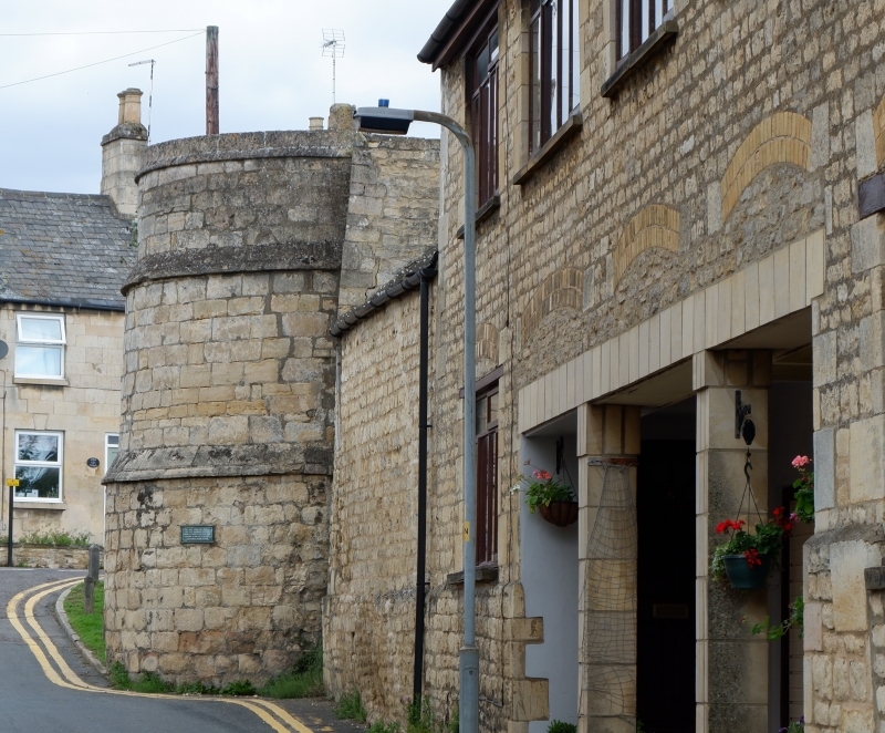
1.
1671 WEST STREET
(East Side)
Bastion
Tf 0206 3/368 22.5.54.
II
2.
West tower of mediaeval walls, near site of St Peter's Gate. At angle of street.
Coursed rubble, 3 stages. One slit opening in top stage.
Listing NGR: TF0251006974
External links are from the relevant listing authority and, where applicable, Wikidata. Wikidata IDs may be related buildings as well as this specific building. If you want to add or update a link, you will need to do so by editing the Wikidata entry.


Other nearby listed buildings
