Approximate Location Map
Large Map »
Latitude: 52.6718 / 52°40'18"N
Longitude: -1.1888 / 1°11'19"W
OS Eastings: 454948
OS Northings: 308543
OS Grid: SK549085
Mapcode National: GBR F24.M3
Mapcode Global: WHDJ9.Q33K
Plus Code: 9C4WMRC6+PF
Entry Name: Shaft of Former Cross in Churchyard of St Mary
Listing Date: 15 March 1984
Grade: II
Source: Historic England
Source ID: 1361076
English Heritage Legacy ID: 189054
ID on this website: 101361076
Location: St Mary's Church, Anstey, Charnwood, Leicestershire, LE7
County: Leicestershire
District: Charnwood
Civil Parish: Anstey
Built-Up Area: Anstey
Traditional County: Leicestershire
Lieutenancy Area (Ceremonial County): Leicestershire
Church of England Parish: Anstey St Mary
Church of England Diocese: Leicester
Tagged with: Churchyard cross
ANSTEY BRADGATE ROAD (North side)
SK 50 NW
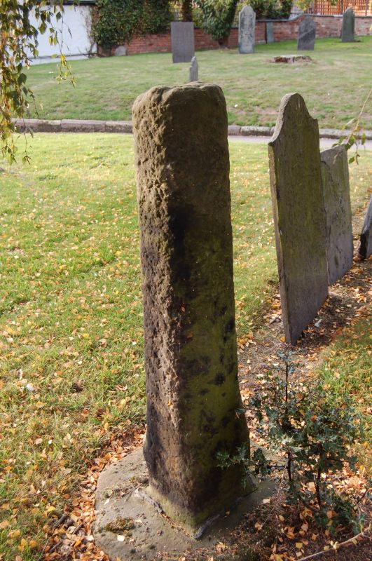
5/3 Shaft of former cross in
Churchyard of St. Mary
GV II
Shaft of former cross of medieval period. Stone shaft of c 1½m on
octagonal stone base. Angles chamfered so as to form an octagon, but
much weathered.
Listing NGR: SK5494808543
External links are from the relevant listing authority and, where applicable, Wikidata. Wikidata IDs may be related buildings as well as this specific building. If you want to add or update a link, you will need to do so by editing the Wikidata entry.


Other nearby listed buildings
