Approximate Location Map
Large Map »
Latitude: 52.699 / 52°41'56"N
Longitude: -1.0725 / 1°4'21"W
OS Eastings: 462773
OS Northings: 311666
OS Grid: SK627116
Mapcode National: GBR 9N2.ZL2
Mapcode Global: WHFK9.HFH6
Plus Code: 9C4WMWXG+JX
Entry Name: 1259, Melton Road
Listing Date: 29 June 1977
Grade: II
Source: Historic England
Source ID: 1361176
English Heritage Legacy ID: 189587
ID on this website: 101361176
Location: Syston, Charnwood, Leicestershire, LE7
County: Leicestershire
District: Charnwood
Civil Parish: Syston
Built-Up Area: Syston
Traditional County: Leicestershire
Lieutenancy Area (Ceremonial County): Leicestershire
Church of England Parish: Syston
Church of England Diocese: Leicester
Tagged with: Building
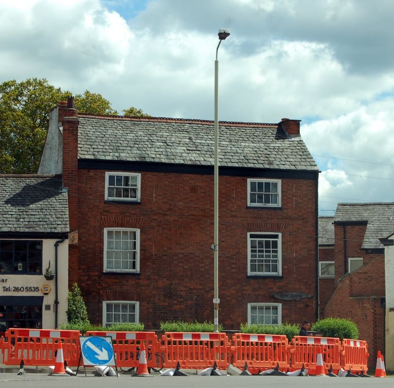
SYSTON
SK 6211 MELTON ROAD (East Side)
9/135 No. 1259
29.6.77
GV II
House, early C19. Brick with Swithland slate roof. 3 storeyed, 2 bays with
side entry. 2 16-light sash windows to ground and 1st floors with flat arched
brick heads. 8-light sashes to attic storey. Plain wood eaves cornice. Gable
end stacks.
Listing NGR: SK6277311666
External links are from the relevant listing authority and, where applicable, Wikidata. Wikidata IDs may be related buildings as well as this specific building. If you want to add or update a link, you will need to do so by editing the Wikidata entry.


Other nearby listed buildings
