Approximate Location Map
Large Map »
Latitude: 52.6702 / 52°40'12"N
Longitude: -0.7299 / 0°43'47"W
OS Eastings: 485981
OS Northings: 308807
OS Grid: SK859088
Mapcode National: GBR CRL.N8S
Mapcode Global: WHFKN.R4MT
Plus Code: 9C4XM7CC+32
Entry Name: 6, Church Street
Listing Date: 24 November 1971
Grade: II
Source: Historic England
Source ID: 1361757
English Heritage Legacy ID: 186462
ID on this website: 101361757
Location: Oakham, Rutland, LE15
County: Rutland
Civil Parish: Oakham
Built-Up Area: Oakham
Traditional County: Rutland
Lieutenancy Area (Ceremonial County): Rutland
Church of England Parish: Oakham All Saints
Church of England Diocese: Peterborough
Tagged with: Building Thatched cottage
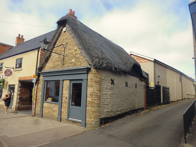
CHURCH STREET
1.
1469
(West Side)
No 6
SK 8508 6/23
II
2.
1-storey cottage with gable end to street. Thatched roof. Ornamental
bargeboarding to gable. Probably of early date. Rubble. Brick modern
extension to rear. Small early Cl9 shop front. Modern glass door.
Side elevation has 1 blocked window and a gabled dormer. Painted plinth.
Listing NGR: SK8598108807
External links are from the relevant listing authority and, where applicable, Wikidata. Wikidata IDs may be related buildings as well as this specific building. If you want to add or update a link, you will need to do so by editing the Wikidata entry.


Other nearby listed buildings
