Approximate Location Map
Large Map »
Latitude: 53.6148 / 53°36'53"N
Longitude: -2.6099 / 2°36'35"W
OS Eastings: 359749
OS Northings: 413312
OS Grid: SD597133
Mapcode National: GBR BV6M.RX
Mapcode Global: WH97K.WDCN
Plus Code: 9C5VJ97R+W2
Entry Name: Rigshaw Bridge Number 70
Listing Date: 21 February 1984
Grade: II
Source: Historic England
Source ID: 1362064
English Heritage Legacy ID: 357523
ID on this website: 101362064
Location: Fairview, Chorley, Lancashire, PR7
County: Lancashire
District: Chorley
Civil Parish: Adlington
Traditional County: Lancashire
Lieutenancy Area (Ceremonial County): Lancashire
Church of England Parish: Adlington St Paul
Church of England Diocese: Blackburn
Tagged with: Bridge
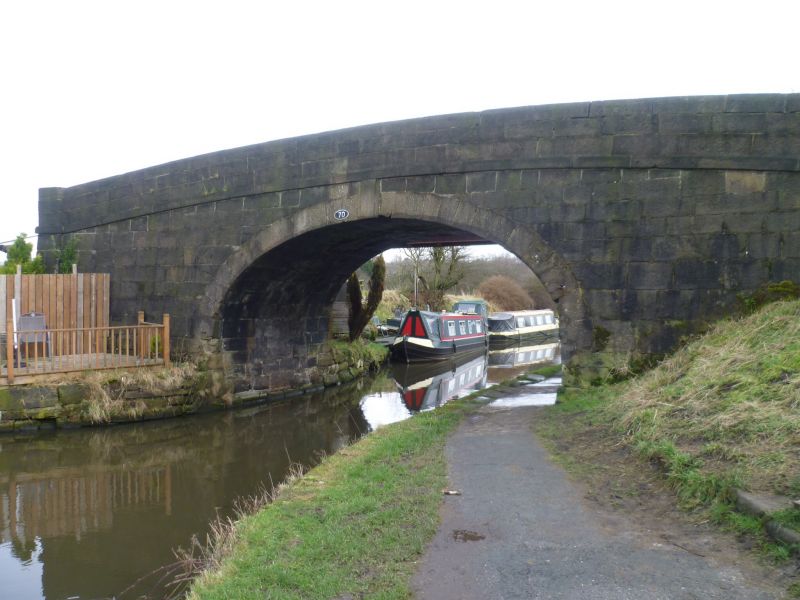
SD 51 SE ADLINGTON off WESTHOUGHTON ROAD
8/9 Rigshaw Bridge No. 70
-
- II
Canal bridge on Leeds - Liverpool Canal, c.1800. Stone. Elliptical arch
with voussoirs and keystone, band, parapets with rounded tops; pilasters
at each end.
Listing NGR: SD5974913312
External links are from the relevant listing authority and, where applicable, Wikidata. Wikidata IDs may be related buildings as well as this specific building. If you want to add or update a link, you will need to do so by editing the Wikidata entry.


Other nearby listed buildings
