Approximate Location Map
Large Map »
Latitude: 51.1687 / 51°10'7"N
Longitude: 0.7406 / 0°44'26"E
OS Eastings: 591693
OS Northings: 144616
OS Grid: TQ916446
Mapcode National: GBR RWB.N1K
Mapcode Global: VHKKC.SWCH
Plus Code: 9F325P9R+F6
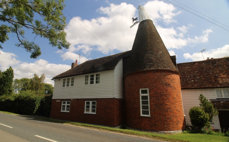
Entry Name: The Oast House
Listing Date: 10 October 1980
Grade: II
Source: Historic England
Source ID: 1362686
English Heritage Legacy ID: 181114
ID on this website: 101362686
Location: Pluckley Thorne, Ashford, Kent, TN27
County: Kent
District: Ashford
Civil Parish: Pluckley
Built-Up Area: Pluckley Thorne
Traditional County: Kent
Lieutenancy Area (Ceremonial County): Kent
Tagged with: Drying house
This list entry was subject to a Minor Amendment on 11 September 2023 to update the name and address and to reformat the text to current standards
TQ 94 SW
14/154A
PLUCKLEY
SMARDEN ROAD
The Oast House
(Formerly listed as Oasthouse adjoinimg Bakers Mead)
II
C19 cylindrical brick oast with cornice of brick nogging attached to two storey outbuilding; the ground floor of red brick, the first floor weatherboarded.
Listing NGR: TQ9169344616
External links are from the relevant listing authority and, where applicable, Wikidata. Wikidata IDs may be related buildings as well as this specific building. If you want to add or update a link, you will need to do so by editing the Wikidata entry.


Other nearby listed buildings
