Approximate Location Map
Large Map »
Latitude: 51.2672 / 51°16'1"N
Longitude: 0.3772 / 0°22'38"E
OS Eastings: 565940
OS Northings: 154685
OS Grid: TQ659546
Mapcode National: GBR NPQ.D75
Mapcode Global: VHJMB.HD9Y
Plus Code: 9F32798G+VV
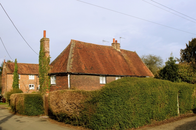
Entry Name: Rose Cottage
Listing Date: 19 April 1985
Grade: II
Source: Historic England
Source ID: 1363004
English Heritage Legacy ID: 178862
ID on this website: 101363004
Location: Herne Pound, Tonbridge and Malling, Kent, ME18
County: Kent
District: Tonbridge and Malling
Civil Parish: Mereworth
Traditional County: Kent
Lieutenancy Area (Ceremonial County): Kent
Church of England Parish: Mereworth St Lawrence
Church of England Diocese: Rochester
Tagged with: Cottage
TQ 65 SE MEREWORTH BUTCHER'S LANE
(east side)
2/3 No 218 (Rose Cottage)
- II
-
Hall house, now house. C16, later altered. Brick ground floor, tile-hung
1st floor. Step hipped plain tiled roof. Ridge stack to east, and stack to
west. 2 storeys, irregular 3 window facade, casements. Later wing to north
with entrance.
Listing NGR: TQ6594054684
External links are from the relevant listing authority and, where applicable, Wikidata. Wikidata IDs may be related buildings as well as this specific building. If you want to add or update a link, you will need to do so by editing the Wikidata entry.


Other nearby listed buildings
