Approximate Location Map
Large Map »
Latitude: 51.2469 / 51°14'48"N
Longitude: 0.3282 / 0°19'41"E
OS Eastings: 562591
OS Northings: 152319
OS Grid: TQ625523
Mapcode National: GBR NPT.RT4
Mapcode Global: VHHPV.MXVJ
Plus Code: 9F3268WH+P7
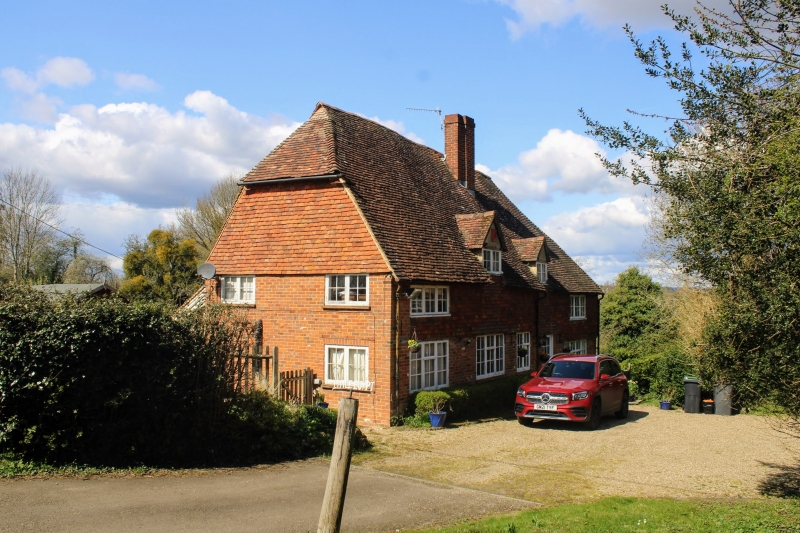
Entry Name: Little Egypt
Listing Date: 19 April 1985
Grade: II
Source: Historic England
Source ID: 1363043
English Heritage Legacy ID: 178967
ID on this website: 101363043
Location: Tonbridge and Malling, Kent, TN11
County: Kent
District: Tonbridge and Malling
Civil Parish: West Peckham
Traditional County: Kent
Lieutenancy Area (Ceremonial County): Kent
Church of England Parish: West Peckham St Dunstan
Church of England Diocese: Rochester
Tagged with: Architectural structure
TQ 65 SW WEST PECKHAM PARK ROAD (north side)
1/4 Little Egypt
-
- II
House, possibly C16 in origin, altered in C18 and Cl9. Red brick ground-floor, tile-
hung 1st floor, with some exposed timber-framing on ground-floor. Plain tiled
roof with 2 small dormers. 2 storeys, irregular 3 window front. Boarded
door.
Listing NGR: TQ6259152319
External links are from the relevant listing authority and, where applicable, Wikidata. Wikidata IDs may be related buildings as well as this specific building. If you want to add or update a link, you will need to do so by editing the Wikidata entry.


Other nearby listed buildings
