Approximate Location Map
Large Map »
Latitude: 51.126 / 51°7'33"N
Longitude: 1.3172 / 1°19'1"E
OS Eastings: 632209
OS Northings: 141530
OS Grid: TR322415
Mapcode National: GBR X2Z.9V1
Mapcode Global: VHLHB.SY6Q
Plus Code: 9F3348G8+9V
Entry Name: 5, St James's Street
Listing Date: 25 September 1973
Grade: II
Source: Historic England
Source ID: 1363191
English Heritage Legacy ID: 177815
ID on this website: 101363191
Location: Victoria Park Mews, Dover, Kent, CT16
County: Kent
District: Dover
Civil Parish: Dover
Built-Up Area: Dover
Traditional County: Kent
Lieutenancy Area (Ceremonial County): Kent
Tagged with: Building
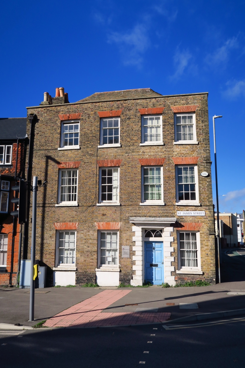
ST JAMES'S STREET
1. (North West Side)
1050
No 5
TR 3241 1/16 25.9.73.
II
2.
Early C19 or earlier. 3 storeys and basement brown brick with red brick
relieving arches. Hipped tiled roof with parapet and stone coping. 4 sashes
with glazing bars intact and brick heads. Plinth. Rusticated door surround
with rectangular fanlight and 6 fielded panelled door. The rear elevation
has a later C19 2 storeys red brick extension with hipped roof and sashes.
Listing NGR: TR3220941530
External links are from the relevant listing authority and, where applicable, Wikidata. Wikidata IDs may be related buildings as well as this specific building. If you want to add or update a link, you will need to do so by editing the Wikidata entry.


Other nearby listed buildings
