Approximate Location Map
Large Map »
Latitude: 51.1851 / 51°11'6"N
Longitude: 1.3754 / 1°22'31"E
OS Eastings: 635983
OS Northings: 148294
OS Grid: TR359482
Mapcode National: GBR X29.LKT
Mapcode Global: VHLH5.SGHT
Plus Code: 9F3359PG+35
Entry Name: Chest Tomb About 10 Metres South of Church of St Nicholas
Listing Date: 23 April 1987
Grade: II
Source: Historic England
Source ID: 1363361
English Heritage Legacy ID: 178481
ID on this website: 101363361
Location: St Nicholas's Church, Ringwould, Dover, Kent, CT14
County: Kent
District: Dover
Civil Parish: Ringwould with Kingsdown
Traditional County: Kent
Lieutenancy Area (Ceremonial County): Kent
Tagged with: Chest tomb
TR 34 NE RINGWOULD CHURCH LANE
(south side)
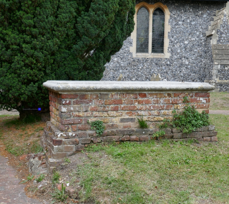
Chest tomb about
3/42 10 metres south
of church of
St. Nicholas
GV II
Chest tomb. Late C17. Red brick with stone top slab. Double moulded
plinth and moulded slab, the inscription illegible. Included for group
value.
Listing NGR: TR3590548404
External links are from the relevant listing authority and, where applicable, Wikidata. Wikidata IDs may be related buildings as well as this specific building. If you want to add or update a link, you will need to do so by editing the Wikidata entry.


Other nearby listed buildings
