Approximate Location Map
Large Map »
Latitude: 51.2249 / 51°13'29"N
Longitude: 1.4041 / 1°24'14"E
OS Eastings: 637778
OS Northings: 152802
OS Grid: TR377528
Mapcode National: GBR X1Y.1SY
Mapcode Global: VHMDG.9G4W
Plus Code: 9F336CF3+WJ
Entry Name: 73, Beach Street
Listing Date: 8 February 1974
Grade: II
Source: Historic England
Source ID: 1363409
English Heritage Legacy ID: 176954
ID on this website: 101363409
Location: Deal, Dover, Kent, CT14
County: Kent
District: Dover
Civil Parish: Deal
Built-Up Area: Deal
Traditional County: Kent
Lieutenancy Area (Ceremonial County): Kent
Tagged with: Building
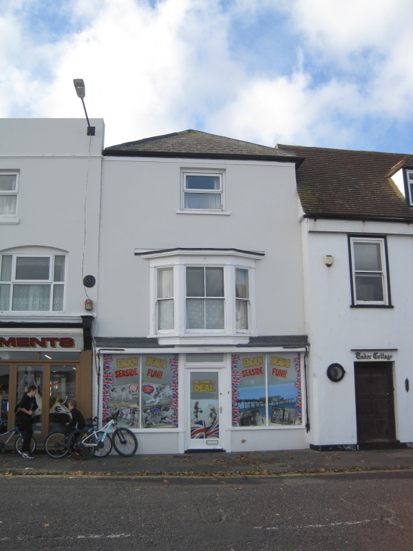
BEACH STREET
1.
1035
(West Side)
No 73
TR 3752 NE 1/191
II GV
2.
Early C19. 3 storeys stuccoed. Hipped slate roof. 1 sash with glazing bars
intact to 2nd floor, 1 3-light bay to 1st floor and a later C19 shopfront. Included
for group value.
Nos 73 to 87 (odd) form a group.
Listing NGR: TR3777852802
External links are from the relevant listing authority and, where applicable, Wikidata. Wikidata IDs may be related buildings as well as this specific building. If you want to add or update a link, you will need to do so by editing the Wikidata entry.


Other nearby listed buildings
