Approximate Location Map
Large Map »
Latitude: 51.2278 / 51°13'40"N
Longitude: 1.4042 / 1°24'15"E
OS Eastings: 637773
OS Northings: 153132
OS Grid: TR377531
Mapcode National: GBR X1R.V4W
Mapcode Global: VHMDG.9D6L
Plus Code: 9F336CH3+4M
Entry Name: 165, Beach Street
Listing Date: 8 February 1974
Grade: II
Source: Historic England
Source ID: 1363434
English Heritage Legacy ID: 176988
ID on this website: 101363434
Location: Deal, Dover, Kent, CT14
County: Kent
District: Dover
Civil Parish: Deal
Built-Up Area: Deal
Traditional County: Kent
Lieutenancy Area (Ceremonial County): Kent
Tagged with: Building
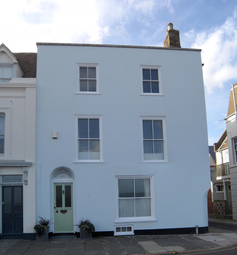
BEACH STREET
1.
1935
(West Side)
No 165
TR 3753 SE 2/31
II GV
2.
Early C19. 3 storeys now stuccoed. 2 sashes with glazing bars missing. Simple
round-headed doorcase.
Nos 157 to 161 (odd) and No 165 form a group.
Listing NGR: TR3777353132
External links are from the relevant listing authority and, where applicable, Wikidata. Wikidata IDs may be related buildings as well as this specific building. If you want to add or update a link, you will need to do so by editing the Wikidata entry.


Other nearby listed buildings
