Approximate Location Map
Large Map »
Latitude: 50.7342 / 50°44'3"N
Longitude: -2.759 / 2°45'32"W
OS Eastings: 346535
OS Northings: 93004
OS Grid: SY465930
Mapcode National: GBR PP.0BTD
Mapcode Global: FRA 5734.GZL
Plus Code: 9C2VP6MR+MC
Entry Name: 5 and 7, North Street
Listing Date: 19 September 1975
Grade: II
Source: Historic England
Source ID: 1366050
English Heritage Legacy ID: 401818
ID on this website: 101366050
Location: Bridport, Dorset, DT6
County: Dorset
Civil Parish: Bridport
Built-Up Area: Bridport
Traditional County: Dorset
Lieutenancy Area (Ceremonial County): Dorset
Church of England Parish: Bridport St Mary
Church of England Diocese: Salisbury
Tagged with: Building
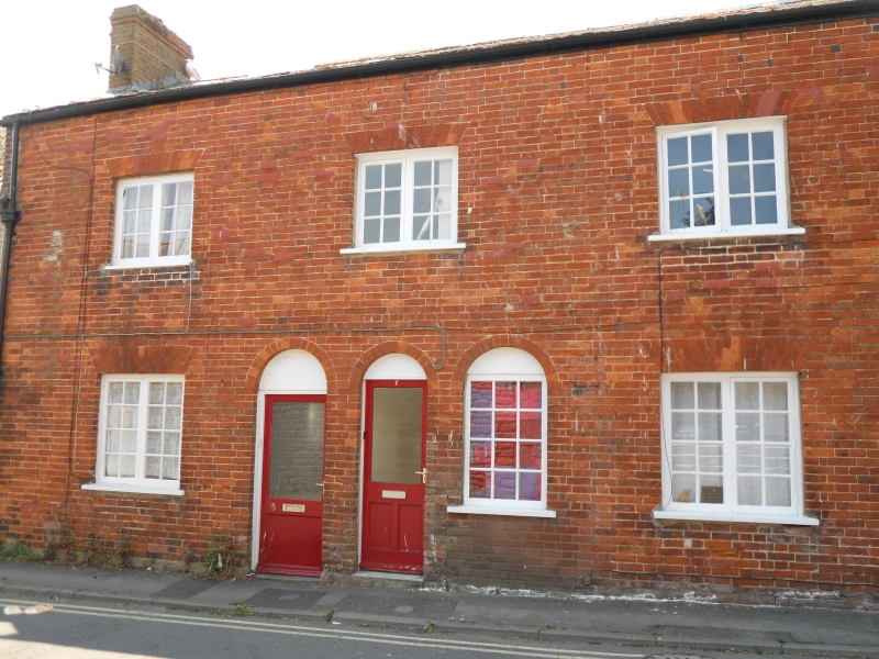
1. NORTH STREET
5191 (West Side)
Nos 5 and 7
SY 4693 2/344
II GV
2.
Late C18. Red brick. Hammer dressed stone plinth. Pitch slate roof. Red
brick stack. 2 storeys. 3 ranges of casements with glazing bars. 2 doors
(1 flush- panelled) and 1 adjacent window (formerly a door), all with blind
semi-circular fanlights.
Nos 1 to 7 (odd) and the former stables to the Royal Oak Public House form a group.
Listing NGR: SY4653393004
External links are from the relevant listing authority and, where applicable, Wikidata. Wikidata IDs may be related buildings as well as this specific building. If you want to add or update a link, you will need to do so by editing the Wikidata entry.


Other nearby listed buildings
