Approximate Location Map
Large Map »
Latitude: 51.0953 / 51°5'43"N
Longitude: 0.5297 / 0°31'46"E
OS Eastings: 577233
OS Northings: 135933
OS Grid: TQ772359
Mapcode National: GBR PTC.8RD
Mapcode Global: FRA D607.65P
Plus Code: 9F323GWH+4V
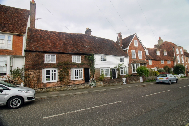
Entry Name: May Cottage
Listing Date: 19 May 1986
Grade: II
Source: Historic England
Source ID: 1366290
English Heritage Legacy ID: 169013
ID on this website: 101366290
Location: Cranbrook, Tunbridge Wells, Kent, TN17
County: Kent
District: Tunbridge Wells
Civil Parish: Cranbrook & Sissinghurst
Built-Up Area: Cranbrook
Traditional County: Kent
Lieutenancy Area (Ceremonial County): Kent
Tagged with: Cottage
CRANBROOK HIGH STREET
TQ 7735 NW
(north side)
11/164
- May Cottage
GV II
Cottage. C17 with C18 cladding. Timber framed with red brick cladding on
ground floor and tile hung first floor. Plain tiled roof with brick end stack
to left. 2 storeys. Irregular 2 window front, with C19 casements on first
floor and 2 flat-headed bays on ground floor. Boarded door at extreme right.
Listing NGR: TQ7723435934
External links are from the relevant listing authority and, where applicable, Wikidata. Wikidata IDs may be related buildings as well as this specific building. If you want to add or update a link, you will need to do so by editing the Wikidata entry.


Other nearby listed buildings
