Approximate Location Map
Large Map »
Latitude: 52.6165 / 52°36'59"N
Longitude: -2.4415 / 2°26'29"W
OS Eastings: 370204
OS Northings: 302176
OS Grid: SJ702021
Mapcode National: GBR BY.87N0
Mapcode Global: WH9DH.GHLG
Plus Code: 9C4VJH85+J9
Entry Name: 60 and 61, Coalport High Street
Listing Date: 22 January 1975
Grade: II
Source: Historic England
Source ID: 1367383
English Heritage Legacy ID: 362012
ID on this website: 101367383
Location: Coalport, Telford and Wrekin, Shropshire, TF8
County: Telford and Wrekin
Civil Parish: The Gorge
Traditional County: Shropshire
Lieutenancy Area (Ceremonial County): Shropshire
Church of England Parish: Madeley
Church of England Diocese: Hereford
Tagged with: Building
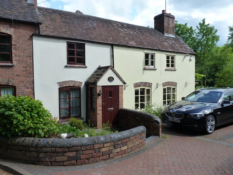
COALPORT COALPORT HIGH STREET
1.
5362 Nos 60 and 61
SJ 70 SW 34/148 22.1.75
II
2.
Early C19 rendered brick cottages, with possible earlier core. Tile roof with gabled
ends. Two-storey, 3-window range. Casements. Two plain wooden doorcases with flush-
panelled doors. No 60 has later bay on left-hand side. Situated at right-angles to
road.
Listing NGR: SJ7020402176
External links are from the relevant listing authority and, where applicable, Wikidata. Wikidata IDs may be related buildings as well as this specific building. If you want to add or update a link, you will need to do so by editing the Wikidata entry.


Other nearby listed buildings
