Approximate Location Map
Large Map »
Latitude: 52.5142 / 52°30'51"N
Longitude: -2.4127 / 2°24'45"W
OS Eastings: 372086
OS Northings: 290780
OS Grid: SO720907
Mapcode National: GBR BZ.GNQM
Mapcode Global: VH915.42BG
Plus Code: 9C4VGH7P+MW
Entry Name: Eardington Villa
Listing Date: 9 March 1970
Grade: II
Source: Historic England
Source ID: 1367536
English Heritage Legacy ID: 254701
ID on this website: 101367536
Location: Eardington, Shropshire, WV16
County: Shropshire
Civil Parish: Eardington
Built-Up Area: Eardington
Traditional County: Shropshire
Lieutenancy Area (Ceremonial County): Shropshire
Church of England Parish: Oldbury
Church of England Diocese: Hereford
Tagged with: Villa
1.
1954 EARDINGTON EARDINGTON
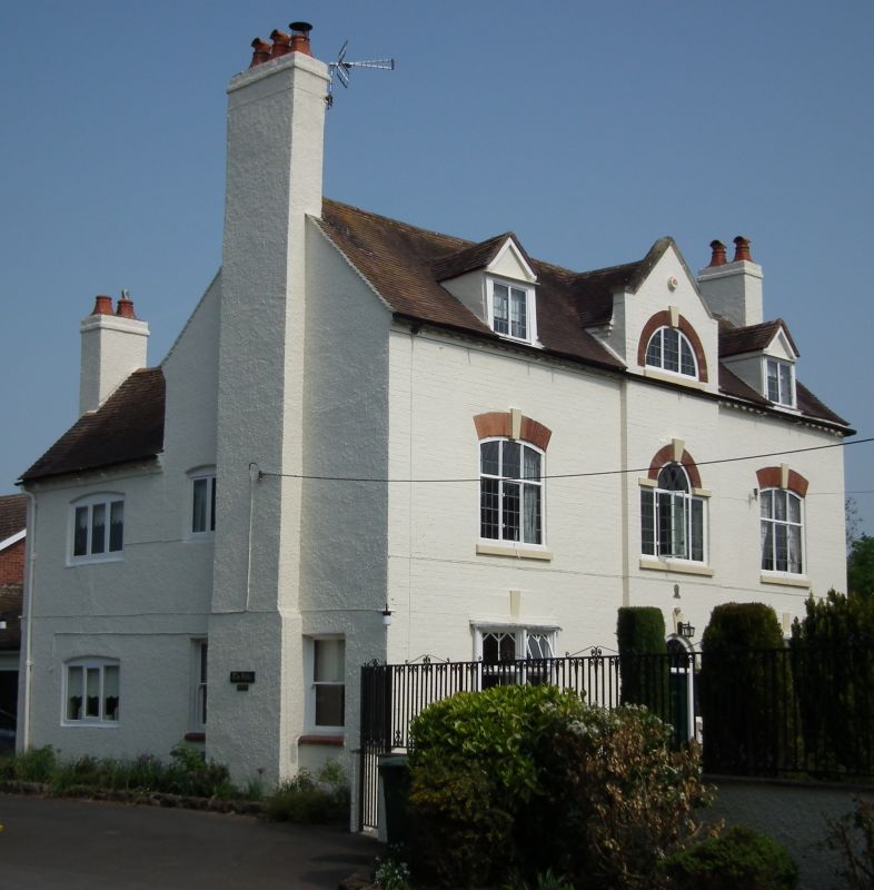
Eardington Villa
SO 79 SW 22/1 9.3.70.
II
2.
Late C18. Brick with tiled roof and brick stacks. Partly roughcast;
2 storeys and attic; central pediment with semi-circular window with keyblock;
3 casement windows, the centre one Venetian; 2 canted bay windows with
Gothick glazing bars. Modern wood tablet with date 1784.
Listing NGR: SO7208690780
External links are from the relevant listing authority and, where applicable, Wikidata. Wikidata IDs may be related buildings as well as this specific building. If you want to add or update a link, you will need to do so by editing the Wikidata entry.


Other nearby listed buildings
