Approximate Location Map
Large Map »
Latitude: 52.5596 / 52°33'34"N
Longitude: -2.3578 / 2°21'28"W
OS Eastings: 375841
OS Northings: 295813
OS Grid: SO758958
Mapcode National: GBR 085.JQM
Mapcode Global: WH9DQ.RXFM
Plus Code: 9C4VHJ5R+RV
Entry Name: Churchyard Walls and Gate Piers
Listing Date: 1 February 1974
Grade: II
Source: Historic England
Source ID: 1367594
English Heritage Legacy ID: 255018
ID on this website: 101367594
Location: Worfield, Shropshire, WV15
County: Shropshire
Civil Parish: Worfield
Built-Up Area: Worfield
Traditional County: Shropshire
Lieutenancy Area (Ceremonial County): Shropshire
Church of England Parish: Worfield
Church of England Diocese: Hereford
Tagged with: Churchyard wall
1.
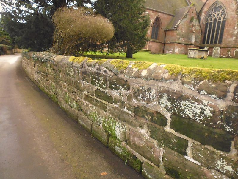
1954 WORFIELD WORFIELD
Churchyard walls
and gate piers
SO 79 NE 16/12
II
2.
Probably C18. Coursed sandstone rubble walls and a pair of ashlar gate
piers with pedimental caps.
Listing NGR: SO7584195813
External links are from the relevant listing authority and, where applicable, Wikidata. Wikidata IDs may be related buildings as well as this specific building. If you want to add or update a link, you will need to do so by editing the Wikidata entry.


Other nearby listed buildings
