Approximate Location Map
Large Map »
Latitude: 51.6742 / 51°40'27"N
Longitude: -1.2782 / 1°16'41"W
OS Eastings: 450008
OS Northings: 197520
OS Grid: SU500975
Mapcode National: GBR 7YK.TYL
Mapcode Global: VHCY6.S5MW
Plus Code: 9C3WMPFC+MP
Entry Name: The Paddocks
Listing Date: 10 December 1971
Grade: II
Source: Historic England
Source ID: 1368354
English Heritage Legacy ID: 250519
ID on this website: 101368354
Location: Abingdon-on-Thames, Vale of White Horse, Oxfordshire, OX14
County: Oxfordshire
District: Vale of White Horse
Civil Parish: Abingdon on Thames
Built-Up Area: Abingdon
Traditional County: Berkshire
Lieutenancy Area (Ceremonial County): Oxfordshire
Church of England Parish: Abingdon-on-Thames
Church of England Diocese: Oxford
Tagged with: Architectural structure
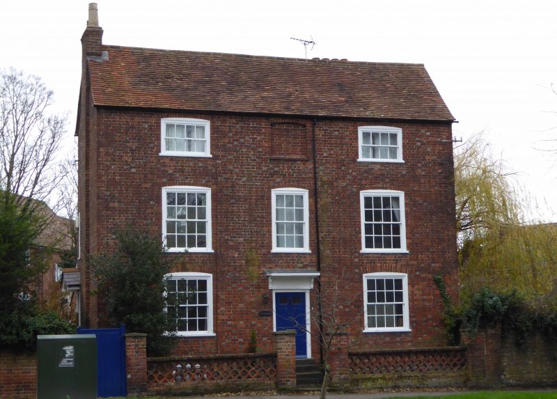
1.
752 VINEYARD
(South Side)
SU 5097 1/404 The Paddocks
II
2.
Early C19. Chequered brick. Tile roof. Three storeys. Three
windows, moulded flush frames, segmental arches, glazing bars.
One window blocked. Six panel door (two panels glass). Flat
wood hood on carved brackets. Four steps.
Listing NGR: SU5000897520
External links are from the relevant listing authority and, where applicable, Wikidata. Wikidata IDs may be related buildings as well as this specific building. If you want to add or update a link, you will need to do so by editing the Wikidata entry.


Other nearby listed buildings
