Approximate Location Map
Large Map »
Latitude: 51.659 / 51°39'32"N
Longitude: -1.5839 / 1°35'1"W
OS Eastings: 428881
OS Northings: 195660
OS Grid: SU288956
Mapcode National: GBR 5VP.VTG
Mapcode Global: VHC0L.HKJK
Plus Code: 9C3WMC58+HF
Entry Name: Gate Piers to Faringdon House
Listing Date: 10 November 1952
Grade: II
Source: Historic England
Source ID: 1368510
English Heritage Legacy ID: 249357
ID on this website: 101368510
Location: Faringdon, Vale of White Horse, Oxfordshire, SN7
County: Oxfordshire
District: Vale of White Horse
Civil Parish: Great Faringdon
Built-Up Area: Faringdon
Traditional County: Berkshire
Lieutenancy Area (Ceremonial County): Oxfordshire
Church of England Parish: Faringdon
Church of England Diocese: Oxford
Tagged with: Gatepost
GREAT FARINGDON CHURCH STREET
SU 2895 (north side)
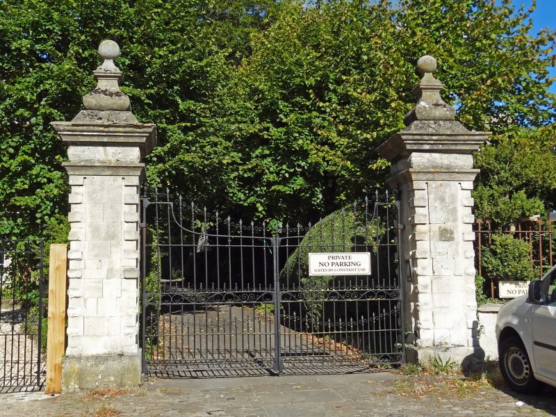
3/17 Gate piers to
Faringdon House
10.11.52
GV II
Later C17 stone gate piers, square plan with small quoin blocks at angles of
shafts, entablature caps with coved architrave, pulvinated frieze and cornice.
Bulbous based finial with ball above. C19 iron gates.
Listing NGR: SU2879395904
External links are from the relevant listing authority and, where applicable, Wikidata. Wikidata IDs may be related buildings as well as this specific building. If you want to add or update a link, you will need to do so by editing the Wikidata entry.


Other nearby listed buildings
