Approximate Location Map
Large Map »
Latitude: 51.5925 / 51°35'33"N
Longitude: -1.2353 / 1°14'6"W
OS Eastings: 453072
OS Northings: 188461
OS Grid: SU530884
Mapcode National: GBR 913.0K1
Mapcode Global: VHCYM.J7TJ
Plus Code: 9C3WHQV7+2V
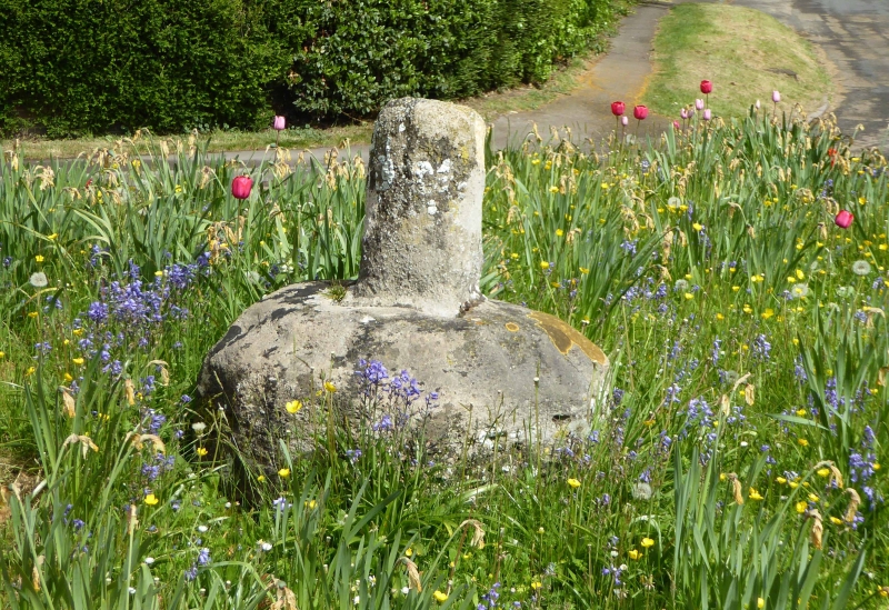
Entry Name: Lower Cross
Listing Date: 4 November 1986
Grade: II
Source: Historic England
Source ID: 1368789
English Heritage Legacy ID: 248644
ID on this website: 101368789
Location: East Hagbourne, South Oxfordshire, OX11
County: Oxfordshire
District: South Oxfordshire
Civil Parish: East Hagbourne
Built-Up Area: Didcot
Traditional County: Berkshire
Lieutenancy Area (Ceremonial County): Oxfordshire
Church of England Parish: Hagbourne
Church of England Diocese: Oxford
Tagged with: Stone cross
EAST HAGBOURNE MAIN ROAD
SU5388 (North side)
15/31 Lower Cross
GV II
Cross. C15. Stone. Octagonal base with worn base of pillar.
Listing NGR: SU5307188458
External links are from the relevant listing authority and, where applicable, Wikidata. Wikidata IDs may be related buildings as well as this specific building. If you want to add or update a link, you will need to do so by editing the Wikidata entry.


Other nearby listed buildings
